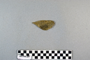
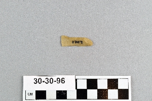
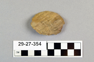
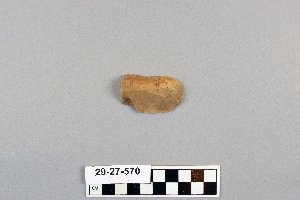
Search Collections
- Object[447]
- yes[447]
- no[447]
- american[447]
- abilene[23]
- alibates creek[16]
- anderson lake[14]
- antelope creek[19]
- apache canyon[1]
- aransas county[5]
- arizona[4]
- beck forest lake[8]
- bivens estate ranch[11]
- bivens ranch[1]
- blowout mountain[6]
- buffalo gap[11]
- canadian river[65]
- clovis[19]
- colorado[4]
- cottonwood creek (texas)[7]
- curry county[1]
- deal[10]
- elgin[1]
- elm creek[57]
- fanny jones ranch[1]
- garrett[2]
- gould ruin[18]
- gravel pit[3]
- gulf of mexico[3]
- handley ranch[22]
- high terrace[2]
- indian hill[23]
- jackson ruins[4]
- kings ruins[12]
- kroenig ranch[3]
- laguna madre island[8]
- laguna madre islands[4]
- lake[1]
- landergin[29]
- lendsey farm[29]
- logan (new mexico)[6]
- mathews ranch[9]
- mora county[1]
- mora river[1]
- mulberry creek[1]
- near abilene[163]
- near alamogordo[1]
- near albany[9]
- near clovis[11]
- near levy[1]
- near questa[2]
- near san jon[1]
- near taos[4]
- near tucumcari[1]
- new mexico[63]
- northwestern united states[1]
- nueces county[9]
- nugent[1]
- nugent ranch[2]
- ochiltree county[4]
- old lake[1]
- otero county[1]
- padre island[3]
- polard lake[3]
- pot creek[4]
- potaler clovis[1]
- potter county (texas)[4]
- pueblo mound[3]
- putnam pit[2]
- quay county[10]
- railroad mountain[4]
- reynold's ranch[2]
- rockport[9]
- rosson's ranch[11]
- second jernada site[1]
- site 10[3]
- site 2[5]
- site 5[4]
- site 6[1]
- site 7[2]
- site 8[2]
- taos county[4]
- tarbox creek[1]
- taylor county[4]
- texas[380]
- troutman ranch[1]
- united states of america[413]
- utah[4]
- watrous[4]
- wolf creek[22]
- wyatt farm[26]
- pueblo[1]
- "mound" - adobe walls[1]
- 0.75 mi beyond bridge[4]
- 0.75 mi. beyond bridge[22]
- 24.5 ft. below surface found with charcoal #32.29[1]
- 6 miles below handley ranch[3]
- anderson lake, about 15 mi. s.e. of clovis, n.m.[12]
- bank of elm creek 7.5 mi. south of abilene[1]
- basin site[1]
- below surface/above main floor of burnt house[1]
- callo del oso[2]
- camp site[2]
- centre line[9]
- creek bed of elm creek 7.5 mi. south of abilene[1]
- dr. ray's site on clear fork of brazos river[2]
- elm creek near surface site[1]
- elm creek surface site[25]
- first terrace surface[4]
- found 100 yards from putman pit[1]
- gravel pit[11]
- mesa site[6]
- near mouth of elm creek[26]
- old lake 2 mi. sout of gravel pit near clovis, n.m.[1]
- old lake 2 mi. south of gravel pit near clovis, n.m.[1]
- paint creek[25]
- rectangular pit house, 2d/2s, depth 23 in. among ashes under fragment of stone -- near corner within pit house.[1]
- rectangular pit house, 2d/36s[1]
- rectangular pit house, 2d/3b, depth 25 in.[1]
- rectangular pit house, 2d/40s, depth 13 in., on plaster.[1]
- rectangular pit house, 2d/41s, depth 13 in. lying immediately on horizontal plaster.[1]
- rectangular pit house, 2d/49s[1]
- rectangular pit house, 2d/4s[1]
- rectangular pit house, 2d/52s, depth 9 in., above floor in "wash" near platform "break"[1]
- rectangular pit house, 2d/6b, depth 24 in.[1]
- rectangular pit house, 2d/8s[1]
- rectangular pit house, 2d/?b[1]
- region around rockport[8]
- rossen's ranch near lawn[11]
- sand dune surface site near nugent[1]
- sand site[9]
- site 40[1]
- site 48 (dewitt farm)[1]
- sunshine valley[2]
- surface[41]
- surface collection[1]
- surface near deal[9]
- surface near high terrace, 13 mi. south of abilene[1]
- surface site[37]
- surface site in cotton field 1 mi. e. of lawn[3]
- surface site in cotton field mile e. of lawn[11]
- surface site in cotton field mile e. of lawn.[1]
- surface site near abilene[13]
- village site near handley ruin[1]
1 - 32 of 447 Records
1 - 32 of 447 Records