Search Collections
- Object[1,313]
- yes[1,313]
- american[1,313]
- adze[1]
- arrowhead[7]
- biface[1]
- blade[2]
- celt[1]
- chopper[1]
- core[1]
- disc[1]
- drill[6]
- drill point[1]
- flake knife[2]
- flaker[1]
- flakes[2]
- gouge[21]
- gunflint[4]
- hand axe[1]
- implement[3]
- knife[67]
- knife blade[3]
- knives[1]
- point[11]
- scraper[1,313]
- sherd[1]
- spear head[1]
- spearhead[3]
- stone[1]
- stone fragment[1]
- teshoa[15]
- turtleback[7]
- abilene[23]
- adams county (mississippi)[8]
- alibates creek[21]
- anderson lake[32]
- antelope creek[19]
- arizona[33]
- austin (texas)[7]
- bainbridge (pennsylvania)[7]
- beck forest lake[34]
- berks county[11]
- bivens estate ranch[16]
- blowout mountain[7]
- boyertown[11]
- brackettville[7]
- brownsville[7]
- bucks county[41]
- buffalo gap[12]
- california (state)[8]
- canada[10]
- canadian river[65]
- cape henlopen[7]
- chickies[31]
- clinton county[7]
- clovis[91]
- colorado[45]
- corpus christi[7]
- cottonwood creek (texas)[7]
- curry county[7]
- david rose's ranch[7]
- deal[10]
- delaware[14]
- delaware valley[9]
- delaware water gap[10]
- devil's river[25]
- dr. pearce mound[16]
- durango[7]
- east cape[20]
- east tennessee[22]
- eddy county[11]
- elm creek[58]
- fayette county (pennsylvania)[7]
- florence (texas)[18]
- gould ruin[19]
- gravel pit[16]
- handley ranch[23]
- indian hill[25]
- j. w. carruthers ranch[13]
- junction of san juan and colorado rivers[18]
- kings ruins[12]
- kintnersville[8]
- laguna madre island[8]
- lake[10]
- lancaster county (pennsylvania)[64]
- landergin[31]
- lendsey farm[31]
- live oak peninsula[9]
- lock haven[7]
- logan (new mexico)[14]
- louisiana[14]
- mathews ranch[9]
- mercer county[49]
- mexico (central america)[7]
- miniosa draw[10]
- mississippi[23]
- monroe county (pennsylvania)[10]
- montana[8]
- near abilene[167]
- near albany[9]
- near carlsbad[8]
- near clovis[20]
- near nara visa[10]
- near tucumcari[10]
- new jersey[78]
- new mexico[231]
- new york[15]
- nueces county[27]
- overpeck site[8]
- pennsylvania[200]
- polard lake[14]
- quay county[45]
- rincon[8]
- rockport[10]
- rosson's ranch[11]
- siberia[24]
- site 10[14]
- site 2[13]
- site 5[8]
- south dakota[9]
- southeastern utah[32]
- tennessee[11]
- texas[511]
- trenton[43]
- troutman ranch[10]
- united states of america[1,037]
- utah[30]
- williamson county (texas)[19]
- witmer's farm[9]
- wolf creek[23]
- wyatt farm[26]
- wyoming[14]
- finley site[1]
- algonquin[6]
- ancestral pueblo[13]
- apache[2]
- arapaho[1]
- barren ground band[4]
- basket maker[7]
- basket-maker[1]
- blackfeet[1]
- calusa[1]
- chalchihuites[7]
- cherokee[3]
- cheyenne (culture)[1]
- cliff dweller[32]
- cody cultural complex[1]
- cree[1]
- crow (culture)[7]
- eskimo[23]
- iroquois[8]
- laguna[1]
- lapp[1]
- leni lenape[8]
- merikoke[1]
- meroc[1]
- merric[1]
- mogollon[1]
- montagnais[3]
- mound (culture)[1]
- naskapi[6]
- native american[6]
- navajo[1]
- pecos cave dweller[3]
- pueblo[8]
- san juan[2]
- shoshone[2]
- sioux[18]
- st. augustine band[1]
- ute[2]
- weitspekan[2]
- woodland[4]
- yankton[1]
- arctic culture area[1]
- california culture area[8]
- central american[7]
- great basin culture area[7]
- great plains culture area[93]
- northeast culture area[325]
- northwest coast culture area[1]
- plains culture area[1]
- russia[1]
- siberia[24]
- southeast culture area[68]
- southwest culture area[815]
- subarctic culture area[10]
- "mound" - adobe walls[1]
- 0.75 mi beyond bridge[4]
- 0.75 mi. beyond bridge[22]
- 103.1ew 102.4ns[1]
- 2 mi. w. of gravel pit near clovis, n.m.[1]
- 24.5 ft. below surface found with charcoal #32.29[1]
- 6 miles below handley ranch[3]
- abbott farm[1]
- alongside mammoth tusk[1]
- alongside of mammoth tusk[1]
- anderson lake, about 15 mi. s.e. of clovis, n.m.[20]
- approximate 7' level near front of pit.[1]
- bank of elm creek 7.5 mi. south of abilene[1]
- basin site[3]
- battlefield of riel's rebellion[1]
- below surface/above main floor of burnt house[1]
- bison kill/processing area[1]
- blow-out[1]
- bottom level.[2]
- burnt mound[7]
- c' - 9-south[1]
- callo del oso[3]
- camp site[5]
- cave 50-60 miles west of carlsbad[1]
- cave/cliff dwelling[1]
- centre line[9]
- cliff-house in side canyon of forbidden canyon[1]
- creek bed[1]
- creek bed of elm creek 7.5 mi. south of abilene[1]
- deep hearth on south side of erosion island[1]
- dr. ray's site on clear fork of brazos river[2]
- dr. ray's site on clear fork of brazos river.[1]
- elm creek near surface site[1]
- elm creek surface site[25]
- excavated area at junction of squares 10z and 10aa on hard surface (surely of pink consolidated soil)[1]
- field near town[1]
- first terrace surface[4]
- found 1 1/2' to 2' under surface of rear of cave.[1]
- found 100 yards from putman pit[1]
- found in cave on side of mesa e.[1]
- found in place in blue sand with extinct bison[1]
- from "blow-cuts" near finley site, near eden; on surface[1]
- from "blow-outs" near finley site, near eden[4]
- from a shell-heap, near lewes[5]
- from brandywine (laubach) camp-site.[7]
- from roadside gutter[1]
- from rock shelter[2]
- from surface of leibhart-peters farm.[1]
- from surface on flood plain of delaware river[1]
- from two camp sites on old cammann property.[1]
- garden of naval home on gray's ferry road[1]
- gravel pit[12]
- hays stewart farm, operation ii, surface[2]
- house #2[1]
- house 2 entrance[1]
- jasper quarry[1]
- just above mammoth tusk[1]
- killpecker dune field[1]
- lake 15 mi. west[1]
- lake south west[1]
- large cave near pumping station, last chance canyon, west of carlsbad, n.m.[5]
- lofland and gooden farms on either side of cor marsh ditch[5]
- mesa site[6]
- mescal pit in small canyon north of dark canyon near carlsbad, n.m.[1]
- mound[1]
- mounds near austin[6]
- near mouth of elm creek[26]
- near stake 10aa[1]
- old lake 2 mi. sout of gravel pit near clovis, n.m.[1]
- old lake 2 mi. south of gravel pit near clovis, n.m.[2]
- paint creek[25]
- pine station, quiggle farm, operation iii, pit no. g and h, -1 and -2. depth not recorded.[1]
- rectangular pit house, 2d/2s, depth 23 in. among ashes under fragment of stone -- near corner within pit house.[1]
- rectangular pit house, 2d/36s[1]
- rectangular pit house, 2d/3b, depth 25 in.[1]
- rectangular pit house, 2d/40s, depth 13 in., on plaster.[1]
- rectangular pit house, 2d/41s, depth 13 in. lying immediately on horizontal plaster.[1]
- rectangular pit house, 2d/49s[1]
- rectangular pit house, 2d/4s[1]
- rectangular pit house, 2d/52s, depth 9 in., above floor in "wash" near platform "break"[1]
- rectangular pit house, 2d/6b, depth 24 in.[1]
- region around rockport[8]
- rossen's ranch near lawn[11]
- ruin along ancient ditch near englewood[3]
- sand site[9]
- shaw's farm, mouth of pine creek, below lock haen on west branch pf susquehanna river, surface[2]
- shell heap[2]
- shell mounds[2]
- sunshine valley[2]
- surface[62]
- surface and misc. finds[16]
- surface find[4]
- surface finds from site of j. w. carruthers ranch.[13]
- surface near deal[9]
- surface of detritus from cave[10]
- surface site[38]
- surface site in cotton field 1 mi. e. of lawn[3]
- surface site in cotton field mile e. of lawn[11]
- surface site near abilene[13]
- vicinity, surface[2]
- agate[5]
- amethyst[1]
- animal[1]
- animal bone[1]
- antler[3]
- argillaceous material[2]
- argillite[33]
- barite[1]
- basalt[1]
- bear bone[2]
- beaver bone[1]
- bone[16]
- buckskin[3]
- caribou bone[1]
- ceramic[1]
- chalcedony[59]
- chert[166]
- clay[3]
- deer bone[24]
- dolomite[2]
- elk horn[8]
- elkhorn[8]
- felsite[1]
- fiber[1]
- fishskin[1]
- flint[526]
- gneiss[2]
- gourd[1]
- hide[5]
- iron[14]
- ivory[1]
- jasper[91]
- leather[3]
- limestone[1]
- metal[9]
- moose bone[4]
- mountain sheep horn[2]
- obsidian[7]
- pigment[2]
- quartz[29]
- quartzite[61]
- rawhide[5]
- red jasper[9]
- rhyolite[19]
- sandstone[1]
- scraper[1]
- shale[3]
- shell[2]
- siltstone[1]
- sinew[1]
- slate[9]
- spissula shell[1]
- stone[190]
- walrus bone[14]
- wood[18]
- yellow jasper[4]
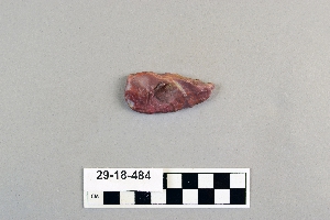
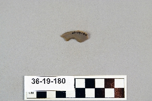
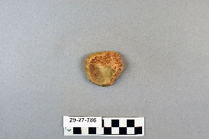
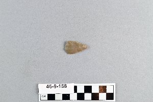
1 - 32 of 1,313 Records

