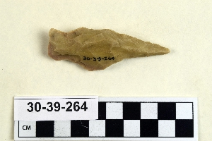
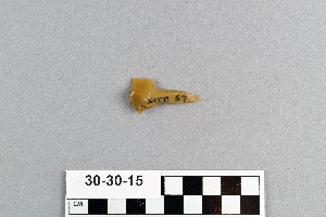
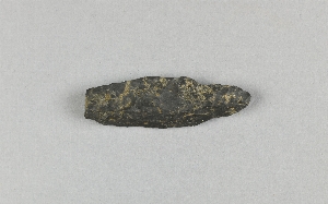
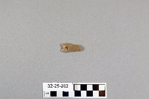
Search Collections
- Object[105]
- no[105]
- american[105]
- arrowhead[1]
- chips[1]
- drill[105]
- engraver (engraving tool)[5]
- engraver point[3]
- point[1]
- adams county (mississippi)[2]
- alaska[7]
- anderson lake[1]
- aransas county[1]
- arkansas[1]
- big timber creek[2]
- brownsville[3]
- bucks county[1]
- burke county[1]
- california (state)[2]
- charlton county[1]
- chesser's island[1]
- chillicothe[1]
- clovis[3]
- cochiti pueblo[1]
- conoy township[3]
- cumberland county (tennessee)[1]
- diamond (ohio)[9]
- distrito federal[1]
- east tennessee[6]
- elgin[8]
- ewing and bragdon site[3]
- fayette county (pennsylvania)[3]
- florida[1]
- floyd county (georgia)[1]
- fly site[4]
- forge island[3]
- frenchman's bay[3]
- fresno county[1]
- georgia[3]
- gloucester county[2]
- gould ruin[4]
- gravel pit[2]
- hancock county (maine)[3]
- handley ranch[4]
- hanging rock[1]
- icy cape[1]
- indian hill[1]
- indiana[2]
- kentucky[1]
- lake[1]
- lancaster county (pennsylvania)[3]
- landergin[1]
- lawrence county[1]
- maine[3]
- mammoth cave[1]
- marietta (ohio)[2]
- marshall county[3]
- mercer county[2]
- mexico (central america)[1]
- michigan[3]
- mississippi[6]
- monongahela river[3]
- morrisville[1]
- natchez[1]
- natchez (mississippi)[1]
- near clovis[1]
- new jersey[4]
- new mexico[5]
- north america[1]
- north carolina[1]
- northern alaska[2]
- northwest alaska[2]
- ohio[15]
- ohio county[3]
- ohio river valley[5]
- okay[1]
- okefinokee swamp[1]
- palmyra township[9]
- pennsylvania[19]
- philadelphia county[1]
- point barrow region[1]
- point hope[1]
- portage county[9]
- red canyon[1]
- richland county[1]
- rome (georgia)[1]
- ross county[1]
- san juan teotihuacan[1]
- san miguel island[1]
- shelby[1]
- shell bluff[1]
- southeastern utah[1]
- sullivan county (indiana)[1]
- tampa bay[1]
- tennessee[3]
- texas[14]
- tranquillity[1]
- tranquillity site[1]
- trenton[2]
- united states of america[85]
- unites states of america[9]
- utkiavik[1]
- washington county (ohio)[1]
- west virginia[3]
- wolf creek[4]
- 2 mi. w. of gravel pit near clovis, n.m.[1]
- anderson lake, about 15 mi. s.e. of clovis, n.m.[1]
- from lake bank 1 mi. s.e. of gravel pit near clovis, n.m.[1]
- in susquehanna river[3]
- lake 15 mi. west[1]
- loose on surface of slough, south of sump 1, about in middle of channel as of 1944[1]
- mound 1 near chesser's house[1]
- opposite locust grove haldeman estate[3]
- shores of delaware river at morrisville, pa., and trenton, n.j.[1]
- chipped[52]
1 - 32 of 105 Records