Search Collections
- Object[1,690]
- no[1,690]
- american[1,690]
- 3D Model[1]
- animal[1]
- arrow[5]
- arrow blade[47]
- arrow point[1]
- arrowhead[100]
- arrowhead fragment[1]
- arrowheads[6]
- awl point[2]
- axe[1]
- bannerstone[1]
- bead[1]
- beads[1]
- biface[10]
- blade[147]
- blades[6]
- blank[3]
- burin[1]
- celt[39]
- charcoal[2]
- chip[6]
- chips[9]
- chisel[4]
- core[10]
- cores[22]
- debitage[20]
- drill[39]
- effigy[1]
- encrinite[2]
- end blade fragment[1]
- end scraper[5]
- flake[211]
- flakes[15]
- flint[1]
- folsom point[1]
- foreshaft[1]
- fossil[3]
- garnet[1]
- graver[1]
- hammerstone[3]
- harpoon head[2]
- implement[22]
- implement fragment[1]
- implements[1]
- jasper[29]
- knife[199]
- knife blade[3]
- knives[8]
- lance blade[1]
- lance head[2]
- nodule[15]
- nodule fragments[1]
- pebble[23]
- pebbles[2]
- pendant[1]
- perforator[1]
- plane[1]
- point[242]
- point fragment[3]
- points[5]
- polishing stone[6]
- projectile point[237]
- projectile point fragment[1]
- projectile points[18]
- reject[12]
- retouched flake[1]
- rocks[1]
- rubbing stone[2]
- sand[2]
- saw[1]
- scraper[107]
- scraper knife[1]
- side blade[1]
- side scraper[1]
- spear head[2]
- spear point[3]
- spearhead[32]
- spearheads[4]
- stone[27]
- stone fragment[5]
- sword[1]
- tool[1]
- trough[1]
- turtleback[3]
- worked stone[1]
- adams county (mississippi)[136]
- alaska[98]
- anderson lake[7]
- arizona[17]
- arkansas[16]
- bainbridge (pennsylvania)[10]
- bartlett shellheep[22]
- beck forest lake[5]
- berks county[34]
- big timber creek[35]
- bingaman plantation[5]
- bolivia[8]
- bonasila[5]
- bridgeport[11]
- bristol (pennsylvania)[6]
- bucks county[129]
- burlington county[83]
- camden county[8]
- cape denbigh[6]
- cape henlopen[7]
- chamberlain plantation[11]
- chester county[11]
- chickies[40]
- clovis[21]
- colorado[17]
- concordia parish[10]
- delaware[26]
- delaware county (pennsylvania)[6]
- delaware valley[41]
- ferguson plantation[8]
- ferriday plantation[7]
- flint ridge[7]
- florence (texas)[7]
- florida[13]
- fort rosalie[11]
- fry's run[6]
- gaultney plantation[9]
- gloucester county[60]
- grafton plantation[10]
- gravel pit[15]
- hamilton[31]
- hamilton square[31]
- hansell farm[6]
- henry gault mound[6]
- iredell county[6]
- iyatayet[6]
- jefferson county (mississippi)[42]
- kent county (delaware)[9]
- kent county (maryland)[6]
- lancaster county (pennsylvania)[83]
- lehigh county[119]
- limeport[24]
- logan township[11]
- louisiana[76]
- lower yukon river valley[6]
- lumberton[17]
- macungie[85]
- marshall county[8]
- maryland[19]
- medford[7]
- mercer county[203]
- mexico (central america)[10]
- mississippi[250]
- mississippi valley[40]
- monmouth county[23]
- natchez (mississippi)[103]
- new jersey[537]
- new mexico[46]
- new york[6]
- north america[11]
- north carolina[11]
- northampton county[14]
- norton sound[6]
- ohio[15]
- ohio county[8]
- oley[7]
- panama[22]
- pennsylvania[456]
- petersborough[8]
- point hope[57]
- pricetown[9]
- raubsville[6]
- red bank (new jersey)[6]
- riegelsville[58]
- rock retreat[13]
- schuylkill county[7]
- sitio conte[22]
- southeastern utah[16]
- southwest colorado[10]
- sussex county (delaware)[7]
- tennessee[8]
- texas[24]
- tiahuanaco[8]
- trenton[171]
- united states of america[1,557]
- utah[12]
- vera cruz (pennsylvania)[8]
- washington boro[13]
- west virginia[13]
- yukon island[13]
- sitio conte[22]
- ancestral pueblo[1]
- aztec[2]
- basket-maker[9]
- basketmaker[1]
- chalchihuites[4]
- cherokee[1]
- cliff dweller[6]
- cocle[22]
- denbigh flint complex[6]
- eskimo[10]
- inuit[1]
- iroquois[1]
- kachemak bay culture iii[2]
- maya[1]
- natchez[2]
- paleo-indian[4]
- prehistoric eskimo[70]
- southern cheyenne[4]
- thule[1]
- toltec[2]
- andean[8]
- arctic culture area[96]
- california culture area[2]
- central american[33]
- east brazil[1]
- great plains culture area[13]
- north american culture area[4]
- northeast culture area[1,081]
- northeast culture area [1]
- northwest coast culture area[3]
- south american culture area[1]
- southeast culture area[341]
- southwest culture area[104]
- subarctic culture area[2]
- "field east of newton creek near collings road."[1]
- 1 mi. s.e. of gravel pit near clovis, n.m.[2]
- 11'9" - 12'9"[1]
- 16" below surface.[1]
- 2 mi. w. of gravel pit near clovis, n.m.[2]
- 3 h 3' 9", vii[1]
- 4 h[1]
- 4 h, (14' - 14' 6"), layer 1[1]
- 4 k, 13' - 13' 8", layer 1 (?)[1]
- 4 k, 13' 8" - 14' 2", layer 1, bottom of midden[1]
- 5 k (13' 8" - 14'), bottom of midden, layer 1[1]
- 5 k, (13' 8" - 14'), bottom of midden, layer 1[1]
- 5 k, 12' - 12' 6", layer 1[1]
- 8' 6" - 9'[1]
- above floor of porch, house #1[1]
- above roof, house #1[1]
- anderson lake, about 15 mi. s.e. of clovis, n.m.[5]
- b, surface, 9", ix[1]
- banks of connecticut river[1]
- basin site[2]
- beach of terrace #1[1]
- bed of river.[1]
- blow-out[1]
- bottom layer, 5 ft. deep.[4]
- bottom level.[2]
- brought from indian quarries for making implements[7]
- burial 11[21]
- burnt mound[2]
- cave in sec. 13, block 121[1]
- cemetery 2, at or near surface[1]
- charcoal layer above beach on terrace #1[1]
- colorado desert[1]
- field[10]
- field - uncertain[3]
- field near rosalie[1]
- field near second creek[1]
- flint quarry[2]
- floor of porch, house #1[1]
- found in debris filling ancient shaft.[1]
- found near pit, on the surface.[21]
- found on delaware river beach[1]
- from a shell-heap, near lewes[2]
- from below guano deposit[1]
- from brandywine (laubach) camp-site.[21]
- from cache, 3 miles south of trenton (drained meadow).[1]
- from lake 3 mi. w. of gravel pit near clovis, n.m.[2]
- from lake bank 1 mi. s.e. of gravel pit near clovis, n.m.[3]
- from meadow 3 miles south of trenton.[1]
- from road cut[2]
- from roadside gutter[2]
- from rock shelter[3]
- from workshop.[1]
- house 2[1]
- house 322[1]
- in lower loam stratum with charcoal.[1]
- in susquehanna river[1]
- in the lower loam stratum, with charcoal[2]
- indian jasper quarry[1]
- indian jasper quarry, two miles northwest of selingsgrove, snyder county, pa[1]
- indian village site on old keith manour[3]
- ip house[2]
- island opposite locust grove[1]
- iyedm[1]
- iyp[1]
- iypa[1]
- iypc[1]
- iypc 302[1]
- iyz-4[1]
- jasper quarry[3]
- jasper quarry, oven-site. 4 - 6 inches below surface.[2]
- jasper quarry; surface[2]
- k, 5' 6" - 6' 4", layer 4 (?)[1]
- layer 5a in hole in layer 1[1]
- lofland and gooden farms on either side of cor marsh ditch[8]
- loma pelona, surface find[4]
- m, 4' - 4' 6", layer 4 or 3[1]
- mound[4]
- mound - uncertain[3]
- mound 1 near chesser's house[1]
- mounds near austin[1]
- n 0.75, w 2.5 - in level which is continuation of house floor[1]
- near washington[3]
- northwest nebraska[2]
- ohio river banks[1]
- old lake 2 mi. south of gravel pit near clovis, n.m.[3]
- operation iii, pit # e and f, -3[1]
- opposite locust grove haldeman estate[1]
- pine station[1]
- potrero (a)[1]
- quiggle farm[1]
- race course[1]
- ravine[3]
- riddells' island[1]
- shell heap[5]
- shores of delaware river at morrisville, pa., and trenton, n.j.[3]
- stratum of sand at is base[1]
- surface[5]
- surface around gravel pit near clovis, n.m.[3]
- upper layer[9]
- workshop site, 3/8 mile from pit.[56]
- animal[1]
- carved[1]
- chipped[908]
- flaked[15]
- ground[11]
- painted[1]
- perforated[1]
- polished[21]
- unfinished[1]
- unworked[9]
- worked[1]
- actual citation[245]
- general reference[23]
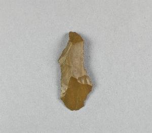
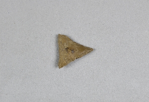
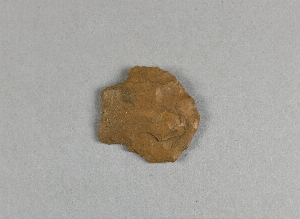
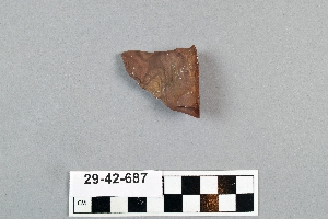
1 - 32 of 1,690 Records


