Search Collections
- Object[309]
- no[309]
- american[309]
- adams county (mississippi)[3]
- adjuntas[2]
- admiralty island[3]
- alaska[86]
- aleutian islands[4]
- arequipa[1]
- attu island[4]
- barrancabermeja[1]
- bates county[1]
- berks county[1]
- blackburn[1]
- blackburn slough[1]
- blount county[1]
- bolivia[6]
- bonasila[1]
- brazil[16]
- brazilian amazonas[9]
- briganca[1]
- british columbia[31]
- brown county (ohio)[1]
- cabildo gramadales[1]
- california (state)[5]
- canada[31]
- cape prince of wales[2]
- chama (guatemala)[1]
- channel islands[4]
- chester river banks[1]
- chickies[1]
- chulumani[4]
- claymont[6]
- colombia[4]
- cook inlet[2]
- costa rica[2]
- cottonwood creek (alaska)[2]
- cumaruara[8]
- davidson county[1]
- daxatkanada fort[4]
- delaware[6]
- delaware water gap[2]
- department of magdalena[1]
- dover[1]
- east tennessee[3]
- florida[1]
- fortaleza[6]
- fox farm[1]
- fraser river[28]
- gravefield i, oldest part[2]
- hawkins island[9]
- indiana[3]
- kachemak bay[2]
- knight island[48]
- kootznahoo inlet[5]
- lago grande[8]
- lancaster county (pennsylvania)[4]
- loiza[3]
- lower yukon river valley[3]
- lytton[27]
- marajo island[6]
- marquette county[21]
- mexico (central america)[7]
- mississippi[3]
- mixteca alta[6]
- mole harbor[3]
- monroe county (pennsylvania)[2]
- montague island[2]
- natchez (mississippi)[3]
- new castle county[6]
- new jersey[2]
- north america[7]
- north carolina[3]
- northwest of the town[4]
- oaxaca (mexican state)[6]
- ohio[7]
- old town[45]
- oregon[2]
- pachacamac[10]
- pachacamac temple[2]
- palugvik village[7]
- panama[28]
- pennsylvania[9]
- peru[28]
- point barrow[2]
- point barrow region[3]
- prince william sound[13]
- puerto rico[6]
- rio curanja[4]
- san nicolas island[2]
- sitio conte[27]
- southeastern utah[2]
- stockdale harbor[2]
- tennessee[9]
- tiahuanaco[2]
- trujillo[11]
- united states of america[152]
- utkiavik[3]
- warren county (tennessee)[4]
- west indies[6]
- wisconsin[22]
- yakutat bay[48]
- yukon island[2]
- sitio conte[27]
- aleutian tradition[1]
- historic[27]
- modern[1]
- old town iii[1]
- aleut[1]
- arawak[6]
- basket-maker[1]
- birdtown band[2]
- cashinahua[4]
- cherokee[2]
- chimu[1]
- chiriqui[1]
- cliff dweller[1]
- cocle[27]
- eskimo[11]
- eyak[2]
- inuit[2]
- kachemak bay culture sub-iii[1]
- marajoaro[6]
- mixtec[6]
- post-contact[3]
- prehistoric eskimo[11]
- prehistoric indian[1]
- salish[29]
- taino[6]
- tairona[3]
- taku tlingit[3]
- tlingit[1]
- yakutat (culture)[3]
- amazonia[20]
- andean[30]
- arctic culture area[38]
- california culture area[6]
- caribbean[6]
- central american[38]
- circum-caribbean[4]
- north american culture area[5]
- northeast culture area[59]
- northwest coast culture area[80]
- plateau culture area[1]
- southeast culture area[14]
- southwest culture area[3]
- subarctic culture area[1]
- 1-s 6-12" below moss. total depth 9-15"[1]
- 2 l 3' 6", vii[1]
- 2md site on right lagoon[1]
- 2nd site on right lagoon[1]
- 4 j surface - 6" layer 9 (and 8?)[1]
- 4 x 3', yellow layer[1]
- 9" to 12" below surface of midden[1]
- above roof of house #2[1]
- at bottom of midden.[1]
- beach below small cave[1]
- d1w 0-6"[1]
- f1e 18"[1]
- f1e 6-12"[1]
- fill of house 9.[1]
- found in a deep excavation above the pachacamac temple.[1]
- found in a deep excavation above the temple pachacamac.[1]
- from storage house fill.[1]
- house 1 fill[1]
- house 12[1]
- house 3' below surface.[1]
- house 8[3]
- house 8 fill[1]
- house 9[1]
- house pit 8 mi. up blackburn slough[1]
- living site on north bank of river a few miles above lytton[1]
- mound b[33]
- mound b, upper 10' in layer of fire-cracked rocks[3]
- mound b, upper level, depth 6-12"[1]
- mound c[1]
- mound i[1]
- niybd b[1]
- north bank of river above stein creek, vicinity of lytton[1]
- old living site on fraser river a few miles south of lytton[1]
- old living site on north bank of fraser river, ten miles above lytton[1]
- old living site on the shore of river[1]
- on the surface near the ancient pillar alley[1]
- richmond[1]
- square e, in dark pebbly sandy shell layer at 28"[1]
- storage house[1]
- stratum i, 2e, 0-9"[3]
- stratum i, a, 0-6"[1]
- stratum i? 1e, level 6[1]
- stratum ii, 2d, level 2[1]
- stratum iii or iv, 2d, level 8[1]
- surface - 2' 6"[1]
- tr. 2, b 11[4]
- tr. 2, b 11 skeleton e[1]
- tr. 2, b 11 skeleton h[4]
- tr. 2, b 11, probably from pottery wall or middle level[15]
- tr. 2, b 12f[1]
- tr. 2, b 19[1]
- upper fraser river[1]
- west side of rio magdalena, near barrancabermeja[1]
- agouti tooth[4]
- animal bone[2]
- animal tooth[2]
- argillite[1]
- bear bone[1]
- beaver tooth[13]
- bird bone[1]
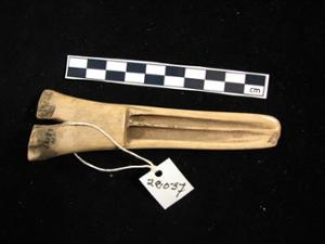
- bone[25]
- bronze[14]
- chalcedony[2]
- chert[1]
- conch shell[3]
- copper[22]
- cord[4]
- flint[4]
- gold[10]
- granite[3]
- grass[4]
- greenstone[5]
- hematite[1]
- iron[2]
- jade[29]
- jasper[4]
- metal[3]
- nephrite[28]
- plaster[3]
- porphyry[1]
- rhyolite[1]
- sandstone[3]
- schist[8]
- seal bone[1]
- shale[2]
- shell[3]
- slate[38]
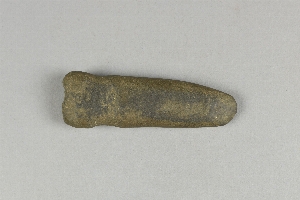
- stone[82]
- tuff[1]
- whalebone[1]
- wood[9]
- chipped[51]
- ground[4]
- groundstone[1]
- incised[1]
- polished[7]
- actual citation[12]
- general reference[15]
1 - 32 of 309 Records