Search Collections
- Object[340]
- yes[340]
- american[90]
- european[185]
- near eastern[64]
- oceanian[1]
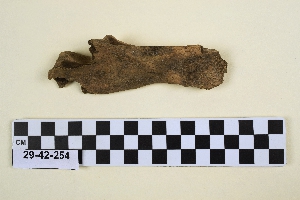
- animal bone[340]
- animal tooth[2]
- antler fragment[1]
- anvil[1]
- astragalus[7]
- awl[1]
- bell[1]
- blade fragment[1]
- calcaneum[4]
- cast[3]
- femur[4]
- first phalanx[14]
- fragment[1]
- humerus[6]
- jaw[10]
- lithic[1]
- long bone[14]
- mandible[2]
- metacarpus[3]
- metatarsus[2]
- molar[2]
- olecranon[1]
- os acetabuli[2]
- os magnum carpi[1]
- patella[2]
- pelvic girdle[1]
- phalanx[1]
- radius[1]
- rib[11]
- scaphoid[2]
- scapula[6]
- second phalanx[8]
- sesamoid[1]
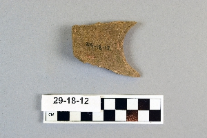
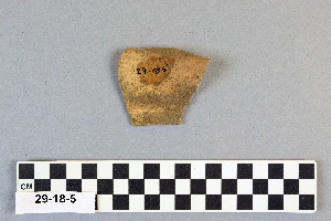
- sherd[1]
- third phalanx[5]
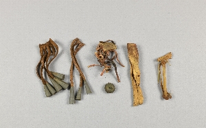
- thong[1]
- tibia[7]
- tool[1]
- tooth[1]
- vertebra[4]
- abri blanchard[33]
- adams county (mississippi)[1]
- alibates creek[12]
- antelope creek[4]
- bartlett shellheep[6]
- belgium[1]
- bern canton[1]
- beth shean[27]
- bivens estate ranch[12]
- bucks county[1]
- burlington county[6]
- california (state)[1]
- canadian river[12]
- cape henlopen[1]
- castel merle[66]
- charente[60]
- chickies[1]
- cliff house[7]
- clinton county[1]
- collier county[1]
- commune d'ehein[1]
- cottonwood creek (texas)[1]
- culberson county[2]
- dauphin county[3]
- delaware[1]
- dordogne[109]
- durham (us)[1]
- eddy county[3]
- engihoul[1]
- europe[7]
- finley site[1]
- florida[1]
- france[175]
- fresno county[1]
- handley ranch[4]
- hotu[3]
- hummelstown cave[3]
- indian hill[10]
- iran[36]
- iraq[1]
- israel[27]
- jones county (texas)[1]
- key marco[1]
- kings ruins[4]
- la madeleine[3]
- la quina[60]
- la souquette[2]
- labatut[33]
- lake moosseedorf[1]
- lancaster county (pennsylvania)[1]
- landergin[10]
- last chance canyon[3]
- les eyzies[5]
- lincoln national forest[3]
- lock haven[1]
- madrid[1]
- malyan[33]
- mentone[2]
- mississippi[2]
- moosseedorf[1]
- near abilene[2]
- near canadian river[1]
- near carlsbad[3]
- near eden[1]
- new jersey[6]
- new mexico[6]
- nippur[1]
- north america[3]
- oceania[1]
- ochiltree county[4]
- oklahoma[1]
- pennsylvania[10]
- putnam pit[1]
- rectangular pit house[11]
- reynold's ranch[1]
- rio grande region[3]
- roches de sergeac[33]
- rue pluvial quarry[1]
- saint-acheul[1]
- san juan drainage[13]
- sandrock cave[3]
- smith creek[1]
- somme[2]
- southeastern utah[14]
- southwest colorado[1]
- spain[1]
- sussex county (delaware)[1]
- sweetwater county[1]
- switzerland[1]
- taylor county[1]
- texas[44]
- tranquillity[1]
- tranquillity site[1]
- united states of america[84]
- williams ranch[2]
- wyoming[1]
- york[4]
- york county (pennsylvania)[4]
- finley site[1]
- aurignacian[6]
- central california phase[1]
- early horizon[1]
- hellenistic[1]
- iron age ia[1]
- iron age iib[4]
- late bronze ib[10]
- late bronze iia[10]
- late bronze iib[9]
- magdalenian[3]
- middle aurignacian[33]
- middle horizon[1]
- modern[1]
- mousterian[58]
- neolithic[1]
- paleoindian[1]
- prehistoric[3]
- roman[1]
- upper aurignacian[33]
- upper mousterian[66]
- ancestral pueblo[1]
- arapaho[1]
- aurignacian[6]
- basket maker[2]
- calusa[1]
- cliff dweller[6]
- cody cultural complex[1]
- magdalenian[3]
- middle aurignacian[33]
- mousterian[58]
- neolithic[1]
- pueblo[3]
- swiss lake dweller[1]
- upper aurignacian[33]
- upper mousterian[66]
- "surface site near abilene"[1]
- 16" below surface.[2]
- a2[2]
- b2[4]
- b2 uncertain[1]
- b3[1]
- b4[5]
- bison kill/processing area[1]
- c2[10]
- c?[1]
- cave[1]
- cave in sec. 13, block 121[2]
- chateau malbarret[5]
- diluvium[1]
- dr. ray's site on clear fork of brazos river[1]
- eusebio cubero quarry[1]
- fourth grotto[2]
- from 3-foot level[4]
- from campsite[1]
- h2[1]
- jasper quarry from large pit.[1]
- jones or taylor counties[1]
- killpecker dune field[1]
- lot 15[1]
- lot 17[1]
- m[3]
- paint creek[1]
- peat deposit[1]
- rectangular pit house, 2d[1]
- rectangular pit house, 2d/10s, depth 21 to 25 in.[1]
- rectangular pit house, 2d/21s, depth 14 to 19 in.[1]
- rectangular pit house, 2d/24s[1]
- rectangular pit house, 2d/30s, depth 26-27 in.[1]
- rectangular pit house, 2d/33s, depth 33 in.[1]
- rectangular pit house, 2d/34s, depth 22-25 in.[2]
- rectangular pit house, 2d/34s?[2]
- rectangular pit house, 2d/46s, from "fire pit" in floor of pit house (i.e. in "blue floor" depth 36 in.)[1]
- rectangular pit house, 2d/4s, "top of hard soil" next to stones -- within pit house (about 10 in. below base of highest horizontal "capstones").[1]
- shell heap[1]
- square 11z[1]
- surface site in cotton field mile e. of lawn[1]
- trench and level[1]
- deer[1]
- animal bone[207]
- animal tooth[2]
- antler fragment[1]
- bear bone[2]
- bison bone[1]
- bone[39]
- bovine bone[27]
- bovine tooth[2]
- ceramic[1]
- cow bone[7]
- deer bone[4]
- elk bone[5]
- flint[2]
- goat bone[1]
- hide[1]
- horse bone[21]
- metal[1]
- plaster[3]
- reindeer bone[33]
- sheep bone[1]
- stone[2]
1 - 32 of 340 Records
1 - 32 of 340 Records