Search Collections
- Object[7,599]
- yes[7,599]
- american[7,225]
- asian[87]
- european[98]
- near eastern[189]
- abrader[1]
- adze[12]
- argillite[30]
- arrowhead[154]
- arrowheads[2]
- awl[5]
- awl point[2]
- axe[109]
- bannerstone[12]
- base[1]
- bead[4]
- biface[11]
- blade[362]
- blade fragment[35]
- blades[5]
- blank[9]
- borer[6]
- boulder (stone)[2]
- cast[4]
- celt[103]
- celt fragment[2]
- ceremonial object[3]
- ceremonial stone[1]
- chalcedony[1]
- chip[30]
- chips[4]
- chisel[14]
- clovis projectile point[2]
- cobble[4]
- core[12]
- dagger[3]
- disk[2]
- drill[125]
- end scraper[35]
- engraver (engraving tool)[5]
- flake[394]
- flake knife[3]
- flake scraper[2]
- flakes[19]
- flint[11]
- folsom point[16]
- game stone[2]
- gorget[11]
- gouge[3]
- graver[4]
- gunflint[7]
- hammer[8]
- hammerstone[22]
- hand chopper[2]
- hoe[2]
- implement[211]
- implements[4]
- jasper[13]
- knife[1,447]
- knives[12]
- lithic[61]
- lithics[36]
- mano stone[2]
- muller[5]
- net sinker[22]
- object[7]
- pebble[99]
- pebbles[4]
- pendant[5]
- perforator[10]
- pestle[4]
- pick[2]
- pick-axe[7]
- point[1,422]
- points[9]
- pot[2]
- projectile point[1,985]
- projectile point fragment[2]
- projectile points[38]
- quartz[3]
- reject[24]
- rubbing stone[4]
- saw[2]
- scraper[529]
- scraper fragment[5]
- sherds[2]
- side scraper[21]
- sinker[6]
- skinning knife[3]
- slate[2]
- spade[3]
- spear point[35]
- spearhead[66]
- specimen[3]
- stem[2]
- stone[59]
- stone chip[2]
- stone fragment[11]
- teshoa[9]
- tool[55]
- tool fragment[2]
- turtleback[2]
- utilized flake[4]
- vessel fragment[2]
- worked stone[3]
- adams county (mississippi)[92]
- albany county[92]
- alibates creek[39]
- anderson lake[99]
- bainbridge (pennsylvania)[70]
- beck forest lake[102]
- belgium[83]
- berks county[485]
- beth shean[189]
- big timber creek[180]
- bivens estate ranch[39]
- boyertown[252]
- bristol (pennsylvania)[37]
- bucks county[290]
- burlington county[33]
- cave[39]
- cayuga county[45]
- chickies[248]
- chubu region[27]
- claymont[27]
- clinton county[34]
- clovis[329]
- colorado river[53]
- conoy township[42]
- corpus christi[36]
- curry county[32]
- delaware[34]
- delaware valley[151]
- eastern pennsylvania[233]
- eastern united states[79]
- elgin[184]
- forge island[42]
- georgetown[82]
- gloucester county[236]
- gravel pit[112]
- hamilton[115]
- hamilton square[115]
- honshu[49]
- israel[189]
- japan[83]
- jefferson county (mississippi)[37]
- lancaster county (pennsylvania)[1,067]
- lehigh county[146]
- live oak peninsula[73]
- lock haven[34]
- locust grove[79]
- long island (ny)[39]
- loudonville[72]
- louisiana[69]
- luzerne county[28]
- macungie[72]
- mercer county[882]
- merrick[37]
- mississippi[188]
- mississippi valley[38]
- missouri[45]
- monmouth county[34]
- morgantown road[60]
- nagano prefecture[27]
- nassau county (new york)[37]
- natchez (mississippi)[79]
- near clovis[38]
- near trenton[28]
- new castle county[27]
- new jersey[1,837]
- new mexico[660]
- new york[294]
- north carolina[50]
- nueces county[59]
- oley[82]
- oregon[94]
- pechoqueolin creek[30]
- pennsylvania[3,209]
- pennsylvania region[31]
- philadelphia[54]
- philadelphia county[54]
- pohopoco creek[32]
- polard lake[30]
- pricetown[73]
- quay county[64]
- rincon[54]
- rock retreat[160]
- shinshiu[28]
- site 10[30]
- site 2[27]
- site 8[28]
- snyder county[41]
- southeastern utah[53]
- spiennes[83]
- susquehanna river[45]
- susquehanna river valley[71]
- susquehanna valley[33]
- texas[654]
- trenton[736]
- trouille valley[47]
- united states of america[6,413]
- washington boro[30]
- williamson county (texas)[95]
- witmer's farm[246]
- wyoming[80]
- finley site[7]
- adena[2]
- archaic[29]
- brewerton focus[17]
- byzantine[1]
- central california phase[21]
- chalcolithic[102]
- early arabic[1]
- early archaic[1]
- early bronze i[31]
- early bronze iii[50]
- early horizon[21]
- historic[7]
- iron age ia[5]
- iron age ib[5]
- iroquois aspect[4]
- jomon[82]
- lamoka focus[12]
- late archaic[28]
- late bronze iib[4]
- late paleolithic[34]
- late woodland period[2]
- laurentian aspect[17]
- middle archaic[1]
- middle horizon[21]
- modern[5]
- neolithic[100]
- neolithic period[47]
- owasco aspect[4]
- palaeolithic[1]
- paleoindian[11]
- paleolithic[13]
- paleolithic, japan[9]
- point peninsula focus[7]
- prehistoric[7]
- temple mound ii[1]
- woodland period[15]
- yayoi[60]
- algonquin[23]
- arawak[1]
- basket maker[1]
- basketmaker[1]
- campignian[1]
- cherokee[48]
- cliff dweller[1]
- clovis[2]
- cody cultural complex[7]
- comanche[9]
- hunterdon county[1]
- indian[4]
- iroquois[31]
- japanese[80]
- jomon[81]
- late paleolithic[31]
- leni lenape[8]
- merikoke[28]
- meroc[28]
- merric[28]
- natchez[1]
- natchez (culture)[1]
- neolithic[89]
- new jersey[1]
- paleo-indian[1]
- paleolithic[14]
- poverty point culture[3]
- pueblo[2]
- taino[1]
- yayoi[59]
- california culture area[21]
- caribbean[1]
- central american[3]
- great basin culture area[1]
- great plains culture area[265]
- north american culture area[9]
- north american culture area culture area[1]
- northeast culture area[5,249]
- northwest coast culture area[126]
- plains culture area[7]
- southeast culture area[391]
- southwest culture area[1,203]
- subarctic culture area[7]
- "johnny-behind-the-deuce cave"[5]
- "mound" - adobe walls[3]
- 1 mi. s.e. of gravel pit near clovis, n.m.[2]
- 1a[1]
- 1a, depth 22 in.[1]
- 2 mi. w. of gravel pit near clovis, n.m.[10]
- 24.5 ft. below surface found with charcoal #32.29[1]
- a known comanche site[5]
- a' - 14 - south[2]
- abbott farm[2]
- alongside of mammoth tusk[2]
- anderson lake, about 15 mi. s.e. of clovis, n.m.[24]
- artificial surface of beach, exposed at low tide.[4]
- banks of laurie's mill pond[7]
- basin site[11]
- bed of river[12]
- bison kill/processing area[7]
- blow-out[2]
- blow-out about 6 miles north of finley site, near farson[2]
- camp site[10]
- cave[29]
- creek bed of elm creek 7.5 mi. south of abilene[7]
- deep hearth on south side of erosion island[10]
- embedded in blue sand[3]
- farm about 3 mi. above lock haven on south bank of west brnach of susquehanne river, surface.[2]
- field[11]
- field - uncertain[4]
- field at chickies.[5]
- field near town[9]
- first terrace surface[12]
- found in excavated blue material[2]
- found near bottom of blue sand. association with bison at gravel pit[2]
- found on surface[5]
- from "blow-cuts" near finley site, near eden; on surface[6]
- from "blow-outs" near finley site, near eden[13]
- from "newer deposits"[2]
- from ancient quarry.[2]
- from bank along clear fork of brazos river about 2.5 mi. east of hawley, texas, found 20 ft. below surface, just below level of a large mammoth tusk.[2]
- from lake 3 mi. w. of gravel pit near clovis, n.m.[8]
- from lake bank 1 mi. s.e. of gravel pit near clovis, n.m.[5]
- from meadows below trenton.[7]
- from old lake 1.5 mi. s.w. of gravelpit about 18 mi. s.w. of clovis[2]
- from old lake west of gravel pit about 18 mi. s.w. of clovis[4]
- from road cut[6]
- from roadside gutter[49]
- from roadside gutter.[3]
- from two camp sites on old cammann property.[36]
- from workshop on gravel terrace, northeast of farson[8]
- gravel exposure on jefferson avenue.[3]
- gravel pit west dump, surface[3]
- gravel surface of upper end of island.[2]
- hays stewart farm, operation ii, surface[4]
- in susquehanna river[42]
- indian village site on old keith manour[12]
- island opposite locust grove[4]
- jasper quarry[3]
- jasper quarry; surface[2]
- just above mammoth tusk[2]
- killpecker dune field[7]
- lake 15 mi. west[5]
- laurie's mill pond[9]
- mescal pit in small canyon north of dark canyon near carlsbad, n.m.[2]
- monro farm, operation i, test pit #1, depth 17 in[5]
- mound[2]
- mound - uncertain[4]
- near extinct bison bones[2]
- near washington[3]
- old lake 2 mi. south of gravel pit near clovis, n.m.[8]
- operation iii, pit no. e and f, -3[2]
- opposite locust grove haldeman estate[42]
- philadelphia marshes[4]
- pine station[3]
- pine station, quiggle farm, operation iii, pit no. e and f, -3. depth, surface to 14 in[2]
- pine station, quiggle farm, operation iii, surface.[5]
- quiggle farm[3]
- ravine[3]
- region around rockport[10]
- riolite quarry[5]
- sand "blowout" 20-25 miles northeast of carlsbad[5]
- sand dune surface site near nugent[3]
- shaw's farm, mouth of pine creek, below lock haen on west branch pf susquehanna river, surface[6]
- shores of delaware river at morrisville, pa., and trenton, n.j.[13]
- site 40 or 41[3]
- square 11z[2]
- strawberry valley, near casas grande[2]
- sunshine valley[2]
- surface[79]
- surface around gravel pit near clovis, n.m.[8]
- surface in blown area[15]
- surface of field[4]
- surface site[18]
- surface, blown area[3]
- terminus of "cut-off" r.r. near morrisville[3]
- this from gravel thrown out in digging sewer trench in center street.[2]
- walled cave rocky arroyo seep 50-60 miles west of carlsbad[2]
- west of morrisville, gravel[4]
- west side of gravel pit[3]
- workshop in ancient quarry.[4]
- workshop on gravel terrace, northeast of farson[12]
- workshop site, 3/8 mile from pit.[56]
- english language[25]
- agate[32]
- andesite[1]
- argillaceous material[96]
- argillite[669]
- basalt[2]
- carnelian[3]
- chalcedony[327]
- charcoal[1]
- chert[743]
- clay[7]
- concretion[1]
- diabase[1]
- diorite[7]
- dolerite[1]
- dolomite[3]
- dolorite[1]
- edwards chert[4]
- felsite[5]
- flint[1,377]
- glass[6]
- gneiss[2]
- granite[7]
- hematite[1]
- hornfels[27]
- hornstone[1]
- jasper[847]
- limestone[5]
- marble (stone)[1]
- metamorphic rock[1]
- mica[1]
- mica schist[2]
- milky quartz[1]
- moss agate[1]
- novaculite[18]
- obsidian[65]
- petrified wood[1]
- plaster[2]
- porphyry[3]
- quartz[800]
- quartz crystal[2]
- quartzite[510]
- red jasper[7]
- rhyolite[202]
- river stone[1]
- sandstone[25]
- schist[4]
- scraper[1]
- shale[68]
- siltstone[6]
- slate[49]
- smoky quartz[1]
- steatite[7]
- stone[1,783]
- white quartz[4]
- chipped[7,599]
- flaked[83]
- grooved[10]
- groundstone[28]
- incised[1]
- pecked[2]
- pitted[1]
- polished[12]
- unfinished[8]
- actual citation[325]
- general reference[6]
- type citation[25]
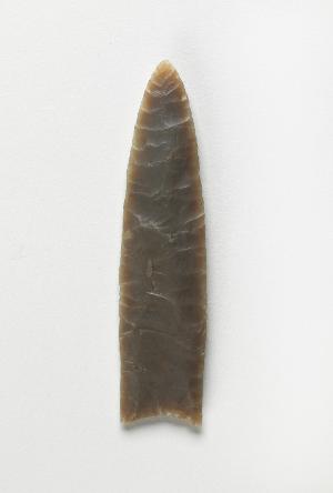
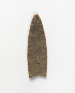
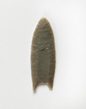
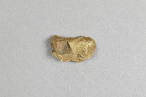
1 - 32 of 7,599 Records


