Search Collections
- Object[1,352]
- yes[1,352]
- no[1,352]
- american[1,352]
- 3D Model[1]
- animal[1]
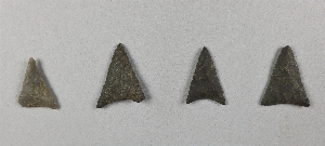
- arrow point[1]
- arrowhead[72]
- arrowhead fragment[1]
- arrowheads[6]
- awl point[2]
- axe[1]
- bannerstone[1]
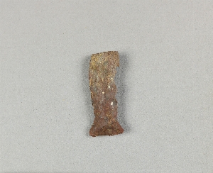
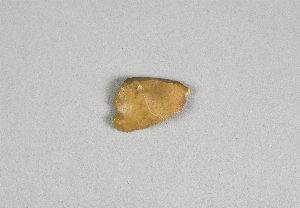
- biface[10]
- blade[137]
- blades[6]
- blank[3]
- celt[34]
- charcoal[2]
- chip[1]
- chips[7]
- chisel[3]
- core[7]
- cores[21]
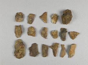
- debitage[20]
- drill[32]
- effigy[1]
- encrinite[2]
- end scraper[3]
- flake[192]
- flakes[15]
- flint[1]
- folsom point[1]
- foreshaft[1]
- fossil[3]
- garnet[1]
- graver[1]
- hammerstone[2]
- implement[21]
- implements[1]
- jasper[23]
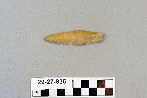
- knife[162]
- knives[6]
- nodule[15]
- nodule fragments[1]
- pebble[22]
- pebbles[2]
- pendant[1]
- perforator[1]
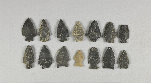
- point[180]
- point fragment[3]
- points[1]
- polishing stone[6]
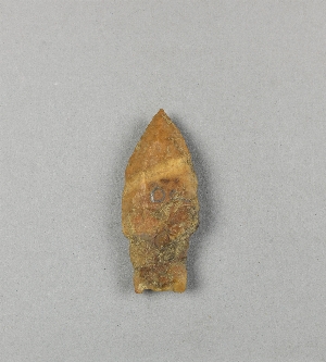
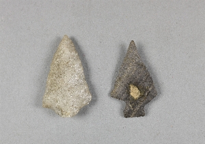
- projectile point[212]
- projectile points[18]
- reject[10]
- rubbing stone[2]
- sand[2]
- saw[1]
- scraper[77]
- scraper knife[1]
- spear head[2]
- spearhead[30]
- spearheads[4]
- stone[12]
- stone fragment[5]
- sword[1]
- tool[1]
- trough[1]
- turtleback[3]
- adams county[3]
- adams county (mississippi)[131]
- anderson lake[5]
- arizona[9]
- atlantic county[4]
- bainbridge (pennsylvania)[10]
- bartlett shellheep[22]
- beasley's point[3]
- berks county[34]
- big timber creek[35]
- bingaman plantation[5]
- bridgeport[11]
- bristol (pennsylvania)[6]
- bucks county[129]
- burlington county[82]
- camden county[8]
- cape henlopen[7]
- cape may county[5]
- catahoula parish[5]
- chamberlain plantation[11]
- chester county[11]
- chickies[40]
- clovis[16]
- colorado[9]
- columbia (pennsylvania)[4]
- concordia parish[10]
- connecticut[4]
- connor plantation[4]
- delaware[26]
- delaware county (pennsylvania)[6]
- delaware valley[41]
- durham (us)[5]
- elliot plantation[5]
- ellis cliff[4]
- ferguson plantation[8]
- ferriday plantation[7]
- flint ridge[7]
- florence (texas)[7]
- fort rosalie[11]
- fry's run[6]
- gaultney plantation[9]
- gillespie plantation[4]
- gloucester county[60]
- grafton plantation[10]
- gravel pit[15]
- hamilton[31]
- hamilton square[31]
- hansell farm[6]
- henry gault mound[6]
- jefferson county (mississippi)[42]
- kent county (delaware)[9]
- kibby plantation[4]
- lancaster county (pennsylvania)[83]
- lehigh county[119]
- limeport[24]
- logan township[11]
- louisiana[74]
- lumberton[17]
- macungie[85]
- markham[4]
- maxatawny township[5]
- medford[7]
- mercer county[203]
- milford (pennsylvania)[4]
- minor plantation[4]
- mississippi[233]
- mississippi valley[40]
- monmouth county[23]
- monterey[5]
- morgantown road[5]
- natchez (mississippi)[103]
- near clovis[5]
- new castle county[5]
- new jersey[533]
- new mexico[21]
- new york[6]
- northampton county[14]
- ohio[5]
- oley[7]
- pechoqueolin creek[5]
- pennsylvania[456]
- petersborough[8]
- pike county (pennsylvania)[4]
- pricetown[9]
- raubsville[6]
- red bank (new jersey)[6]
- riegelsville[58]
- roach plantation[4]
- rock retreat[13]
- schuylkill county[7]
- shellpot creek[4]
- sussex county (delaware)[7]
- texas[24]
- timber creek[5]
- trenton[171]
- united states of america[1,352]
- utah[9]
- vera cruz (pennsylvania)[8]
- washington boro[13]
- wieder's creek[4]
- basketmaker[1]
- cherokee[1]
- cliff dweller[1]
- iroquois[1]
- natchez[2]
- paleo-indian[3]
- "field east of newton creek near collings road."[1]
- 1 mi. s.e. of gravel pit near clovis, n.m.[2]
- 16" below surface.[1]
- 2 mi. w. of gravel pit near clovis, n.m.[2]
- anderson lake, about 15 mi. s.e. of clovis, n.m.[5]
- banks of connecticut river[1]
- bed of river.[1]
- blow-out[1]
- bottom layer, 5 ft. deep.[4]
- bottom level.[2]
- brought from indian quarries for making implements[7]
- burnt mound[2]
- cave in sec. 13, block 121[1]
- field[10]
- field - uncertain[3]
- field near rosalie[1]
- field near second creek[1]
- flint quarry[2]
- found in debris filling ancient shaft.[1]
- found near pit, on the surface.[21]
- found on delaware river beach[1]
- from a shell-heap, near lewes[2]
- from brandywine (laubach) camp-site.[21]
- from cache, 3 miles south of trenton (drained meadow).[1]
- from lake 3 mi. w. of gravel pit near clovis, n.m.[2]
- from lake bank 1 mi. s.e. of gravel pit near clovis, n.m.[3]
- from meadow 3 miles south of trenton.[1]
- from road cut[2]
- from roadside gutter[2]
- from rock shelter[3]
- from workshop.[1]
- in lower loam stratum with charcoal.[1]
- in susquehanna river[1]
- in the lower loam stratum, with charcoal[2]
- indian jasper quarry[1]
- indian jasper quarry, two miles northwest of selingsgrove, snyder county, pa[1]
- indian village site on old keith manour[3]
- island opposite locust grove[1]
- jasper quarry[3]
- jasper quarry, oven-site. 4 - 6 inches below surface.[2]
- jasper quarry; surface[2]
- lofland and gooden farms on either side of cor marsh ditch[8]
- mound[4]
- mound - uncertain[3]
- mounds near austin[1]
- near washington[3]
- northwest nebraska[2]
- ohio river banks[1]
- old lake 2 mi. south of gravel pit near clovis, n.m.[3]
- operation iii, pit # e and f, -3[1]
- opposite locust grove haldeman estate[1]
- pine station[1]
- quiggle farm[1]
- race course[1]
- ravine[3]
- riddells' island[1]
- shell heap[5]
- shores of delaware river at morrisville, pa., and trenton, n.j.[3]
- stratum of sand at is base[1]
- stratum of sand at its base.[1]
- surface[3]
- surface along roadway about 2 miles south of eden[1]
- surface and misc. finds[1]
- surface around gravel pit near clovis, n.m.[3]
- surface finds from site of j. w. carruthers ranch.[1]
- upper layer[9]
- workshop near rim of pit.[1]
- workshop site, 3/8 mile from pit.[56]
- animal[1]
- carved[1]
- chipped[815]
- flaked[15]
- ground[11]
- painted[1]
- perforated[1]
- polished[21]
- unfinished[1]
- unworked[9]
- actual citation[240]
- general reference[1]
1 - 32 of 1,352 Records
1 - 32 of 1,352 Records