Search Collections
- Object[220]
- yes[220]
- no[220]
- american[220]
- animal tooth[1]
- ceremonial object[1]
- charcoal[2]
- lithic[2]
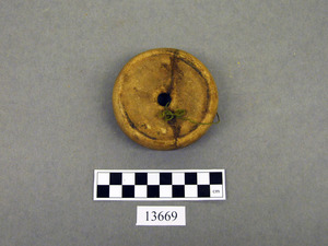
- potter's tool[2]
- shaft scraper[1]
- shell[1]
- sherd[2]
- stone[220]
- adams county (mississippi)[6]
- alaska[1]
- alibates creek[2]
- allegheny county (pennsylvania)[1]
- arizona[2]
- athens[1]
- bates county[3]
- bellmont mound[1]
- big horn basin[1]
- bivens estate ranch[2]
- bordentown[3]
- bradford county[1]
- bristol (pennsylvania)[5]
- bucks county[59]
- burlington county[30]
- burlington island[5]
- caldwell's island[3]
- camden (south carolina)[5]
- camden county[1]
- canadian river[2]
- canyon[1]
- chamberlain plantation[2]
- chester county[1]
- chickies[9]
- claymont[10]
- clinton county[3]
- colorado[1]
- colorado river valley[1]
- crosswick creek[4]
- dauphin county[1]
- delaware[12]
- devil's river[1]
- duboistown[2]
- dunbar plantation[1]
- durham (us)[28]
- easton[1]
- fairview[1]
- ferguson plantation[1]
- finley site[1]
- flint quarry[27]
- fox farm[1]
- fry's run[1]
- gillespie plantation[1]
- gloucester county[4]
- grafton plantation[2]
- graham county (north carolina)[1]
- hamilton[1]
- hamilton square[1]
- hilltown[1]
- hummelstown cave[1]
- indiana[1]
- iredell's creek[2]
- j. w. carruthers ranch[1]
- jefferson county (mississippi)[5]
- kansas[1]
- kentucky[1]
- kibby plantation[1]
- kings ruins[1]
- lake canyon[2]
- lake george region[1]
- lancaster county (pennsylvania)[13]
- lehigh county[1]
- lock haven[3]
- louisiana[2]
- lumberton[1]
- lycoming county[2]
- maricopa county[2]
- medford[5]
- mercer county[15]
- mississippi[14]
- missouri[3]
- montgomery county (pennsylvania)[3]
- moorestown[13]
- morrisville region[7]
- natchez (mississippi)[3]
- near rancocas creek[5]
- new castle county[10]
- new jersey[54]
- new york[2]
- north carolina[3]
- northampton county[2]
- northeast arizona[2]
- penn valley[3]
- pennsylvania[103]
- pike county (pennsylvania)[2]
- pottstown[2]
- prospect[2]
- rancocas creek[6]
- rectangular pit house[2]
- riegelsville[4]
- rock retreat[3]
- shock's mill station[2]
- south carolina[9]
- southeastern utah[4]
- susquehanna river[3]
- tempe[2]
- texas[6]
- trenton[14]
- united states of america[220]
- wyoming[2]
- finley site[1]
- "bottom level"[8]
- "circle" area, 1d, depth 14 in.[1]
- "circle" area, 1d/a, depth 1 to 6 in.[1]
- "intermediate level"[2]
- 40" level[1]
- 7' 5" - 7' 11"[1]
- bison kill/processing area[1]
- dr. ray's site on clear fork of brazos river.[1]
- field near town[3]
- found 3 miles northeast of tempe. (at ruins?)[1]
- from brandywine (laubach) camp-site.[7]
- from fire-place[16]
- from fire-place.[12]
- from ruins 3 miles northwest of tempe.[1]
- from talus.[1]
- gravel exposure on jefferson avenue.[3]
- gravel pit[2]
- gravel surface of upper end of island.[2]
- jasper quarry[1]
- killpecker dune field[1]
- miller's farm[1]
- mound[5]
- near bottom of pit.[1]
- pit 200[1]
- river bed.[1]
- ruin along ancient ditch near englewood[1]
- sapp sheelheap[1]
- surface[1]
- surface finds from site of j. w. carruthers ranch.[1]
- surface of field[1]
- terminus of "cut-off" r.r. near morrisville[3]
- this from gravel thrown out in digging sewer trench in center street.[2]
- west of morrisville, gravel[3]
1 - 32 of 220 Records
1 - 32 of 220 Records