Search Collections
- Object[262]
- american[101]
- egyptian[2]
- european[97]
- near eastern[62]
- animal bone[262]
- animal tooth[1]
- antler fragment[1]
- blade fragment[1]
- cast[2]
- femur[1]
- fragment[1]
- horn (animal part)[1]
- humerus[2]
- jaw[4]
- lithic[1]
- long bone[13]
- pelvic girdle[1]
- phalange[1]
- phalanx[1]
- rib[13]
- scapula[3]
- sesamoid[1]
- sherd[1]
- shoulder blade[1]
- tibia[3]
- tool[1]
- tooth[1]
- vertebra[2]
- aartuz[2]
- abri blanchard[7]
- alaska[15]
- alibates creek[12]
- antelope creek[4]
- aurora (alaska)[1]
- aurora spit[1]
- baq'ah valley[1]
- baracoa[1]
- bartlett shellheep[6]
- belgium[1]
- bell island[1]
- belt cave[7]
- bern canton[1]
- beth shean[32]
- billa[1]
- bivens estate ranch[12]
- bucks county[1]
- burlington county[6]
- california (state)[1]
- canada[2]
- canadian river[11]
- cape denbigh[1]
- cape henlopen[1]
- cape nome[1]
- castel merle[66]
- charente[9]
- chickies[1]
- cliff house[7]
- clinton county[1]
- collier county[2]
- commune d'ehein[1]
- cook inlet[3]
- cuba[1]
- culberson county[2]
- dauphin county[3]
- daxatkanada fort[1]
- delaware[1]
- dinkha[7]
- dordogne[83]
- durham (us)[1]
- eddy county[3]
- egypt[2]
- el-beidha[3]
- engihoul[1]
- europe[1]
- ewing and bragdon site[2]
- fara[2]
- finley site[1]
- florida[3]
- france[93]
- frank fox's place[1]
- frenchman's bay[2]
- fresno county[1]
- gibeon[1]
- hancock county (maine)[2]
- handley ranch[4]
- hasanlu[7]
- hawkins island[1]
- holy cross[1]
- hotu[13]
- hummelstown cave[3]
- indian hill[10]
- indian island[1]
- indian river[1]
- iran[16]
- iraq[6]
- israel[32]
- jarmo[2]
- kachemak bay[3]
- kings ruins[4]
- knight island[5]
- la madeleine[3]
- la quina[9]
- la souquette[2]
- labatut[7]
- landergin[10]
- last chance canyon[3]
- les eyzies[5]
- lincoln national forest[3]
- maine[2]
- near abilene[2]
- near carlsbad[3]
- new jersey[6]
- new mexico[4]
- north america[4]
- ochiltree county[4]
- old town[4]
- pennsylvania[6]
- rectangular pit house[11]
- roches de sergeac[7]
- san juan drainage[12]
- sandrock cave[3]
- southeastern utah[13]
- syria[5]
- texas[43]
- united states of america[92]
- williams ranch[2]
- yakutat bay[5]
- yukon island[2]
- finley site[1]
- aurignacian[6]
- central california phase[1]
- early horizon[1]
- hellenistic[1]
- hellenistic period[3]
- historic[1]
- iron age ia[1]
- iron age iib[4]
- late bronze ib[10]
- late bronze iia[10]
- late bronze iib[11]
- magdalenian[3]
- middle aurignacian[7]
- middle horizon[1]
- modern[2]
- mousterian[9]
- neolithic[1]
- old town ii[2]
- paleoindian[1]
- prehistoric[13]
- roman[1]
- roman period[3]
- upper aurignacian[7]
- upper mousterian[66]
- aurignacian[6]
- basket maker[2]
- calusa[1]
- cliff dweller[5]
- cody cultural complex[1]
- denbigh flint complex[1]
- eskimo[5]
- hellenistic[3]
- magdalenian[3]
- middle aurignacian[7]
- mousterian[9]
- neolithic[1]
- prehistoric eskimo[1]
- prehistoric indian[1]
- pueblo[3]
- roman[3]
- swiss lake dweller[1]
- upper aurignacian[7]
- upper mousterian[66]
- yakutat (culture)[2]
- "surface site near abilene"[1]
- 16" below surface.[2]
- 3[1]
- 4' +[1]
- b2[1]
- b4[1]
- big wall[1]
- bison kill/processing area[1]
- cave[1]
- cave in sec. 13, block 121[2]
- chateau malbarret[5]
- d, 1' - 6", viii or ix[1]
- d2e 6-12"[1]
- dr. ray's site on clear fork of brazos river[1]
- eusebio cubero quarry[1]
- from 3-foot level[4]
- from campsite[1]
- grave[1]
- h, 3' - 3'6", vi[1]
- h2[1]
- house 203[1]
- jasper quarry from large pit.[1]
- jones or taylor counties[1]
- killpecker dune field[1]
- kitchen midden[1]
- level ii, f g 43, cist. i, -6.5 to -6.7[1]
- level iii, f g 43, cist, -4.70, with skeleton cx1[1]
- m[3]
- mound b near house 1, 14-21 inches[1]
- mound b, lower level, depth 20", shell midden[1]
- mound b, lower level, in shell midden[1]
- paint creek[1]
- rectangular pit house, 2d[1]
- rectangular pit house, 2d/10s, depth 21 to 25 in.[1]
- rectangular pit house, 2d/21s, depth 14 to 19 in.[1]
- rectangular pit house, 2d/24s[1]
- rectangular pit house, 2d/30s, depth 26-27 in.[1]
- rectangular pit house, 2d/33s, depth 33 in.[1]
- rectangular pit house, 2d/34s, depth 22-25 in.[2]
- rectangular pit house, 2d/34s?[2]
- rectangular pit house, 2d/46s, from "fire pit" in floor of pit house (i.e. in "blue floor" depth 36 in.)[1]
- rectangular pit house, 2d/4s, "top of hard soil" next to stones -- within pit house (about 10 in. below base of highest horizontal "capstones").[1]
- s 8, t. 282[1]
- shell heap[1]
- square 11z[1]
- storage house, subsurface pit #15, light brown ashy sand[1]
- stratum iv, 1d, level 9[1]
- surface site in cotton field mile e. of lawn[1]
- trench and level[1]
- deer[1]
- animal bone[262]
- animal tooth[4]
- antler fragment[1]
- ceramic[1]
- deer bone[3]
- flint[1]
- goat bone[1]
- horn (animal part)[1]
- horse bone[1]
- plaster[2]
- seal bone[1]
- sheep bone[1]
- stone[2]
1 - 32 of 262 Records
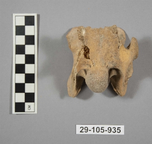
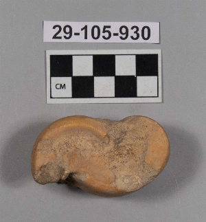
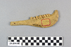
1 - 32 of 262 Records

