Search Collections
- Object[234]
- no[234]
- american[213]
- asian[4]
- european[7]
- near eastern[2]
- oceanian[8]
- alaska[134]
- alaska college[1]
- albany county[3]
- australia[8]
- baluchistan[2]
- baracoa[1]
- bedford county (virginia)[1]
- boulder county[9]
- bridger basin[5]
- cape darby[2]
- cape denbigh[96]
- cape nome[4]
- cayuga county[1]
- chanhu-daro[1]
- charlton county[1]
- chattanooga[4]
- chesser's island[1]
- chickies[6]
- colorado[25]
- cook inlet[4]
- cuba[1]
- cumberland county (tennessee)[2]
- daxatkanada fort[4]
- department of alta verapaz[1]
- east tennessee[2]
- england[1]
- europe[4]
- fairbanks[1]
- finley site[1]
- flint ridge[1]
- florida[12]
- fox farm[2]
- france[1]
- georgia[1]
- gloucester county[1]
- grassy cove[2]
- guatemala[1]
- guyana[2]
- hayes county[2]
- india[1]
- iran[1]
- israel[1]
- iyatayet[96]
- kili ghul mohammad[2]
- knight island[1]
- kootznahoo inlet[4]
- kugusugaruk[2]
- lancaster county (pennsylvania)[9]
- licking county[1]
- locust grove[2]
- lodge pole trail[5]
- loudonville[3]
- maayan barakh[1]
- madjujuinuk site[2]
- mancos[2]
- mancos spring[1]
- mohenjo-daro[1]
- montezuma county[1]
- near eden[1]
- new jersey[1]
- new york[4]
- north america[4]
- north slope borough[2]
- norton sound[98]
- ohio[1]
- oise[1]
- okefinokee swamp[1]
- old town[1]
- pakistan[3]
- pennsylvania[9]
- point barrow region[2]
- rock retreat[5]
- sainville[1]
- san marcos (texas)[2]
- san pedro carcha[1]
- shahr-i qumis[1]
- sweetwater county[1]
- tallahassee[11]
- tennessee[7]
- texas[5]
- unalakleet[3]
- united states of america[106]
- upper essequibo river[2]
- virginia[1]
- west indies[1]
- western europe[1]
- wyoming[6]
- yakutat bay[1]
- yukon island[20]
- yukumnalulum[2]
- chanhu-daro[1]
- finley site[1]
- 10' 8" - 12' 5"[1]
- 4 j, 11' 6" - 13' 9", layer 1[2]
- 4 k, 12' 6" - 13', layer 1[2]
- 4 k, 13' 8" - 14' 2", layer 1, bottom of midden[1]
- 4th of july shaft house[9]
- 5 h, 10' 4" - 10' 12", layer 1[1]
- 5 h, 10' 4" - 12' 10", layer 1[1]
- 5 h, 11' 4" - 11' 6", layer 1[1]
- 5 h, 12' 10" - 13' 6", layer 1[1]
- 5 j, 10' 6" - 11', layer 1[1]
- 5 j, 13' - 13' 9", layer 1, bottom of midden[3]
- 5 k, (13' 8" - 14'), bottom of midden, layer 1[1]
- 5 k, 11' 6" - 12', layer 1[2]
- 9' 6" - 10'[1]
- big wall[1]
- bison kill/processing area[1]
- c2e surface 12". tailings[1]
- carriga barbel[1]
- d2e 6-12"[1]
- f2e 24-30"[1]
- fishpond excavation[2]
- g1w 12-18"[1]
- h1-d[1]
- hc(?)[1]
- hill north of blueberry creek[1]
- house 111[1]
- house 115[1]
- house 119[1]
- house 300[1]
- house pnh (under house 300)[3]
- island opposite locust grove[1]
- iv2-1 dfc[2]
- iy2-3 dfc[1]
- iy2-5d[1]
- iyaa[1]
- iybl[1]
- iye[2]
- iye ll[1]
- iye m[1]
- iye-58[1]
- iyeb 9-10[1]
- iyed[1]
- iyem l[1]
- iyh[2]
- iyh-l uf2[1]
- iyh1 clay[1]
- iyh1 hf.4[1]
- iyh1 uf. 4[1]
- iyh1-c ll[1]
- iyh1-d[1]
- iyh1-e[1]
- iyh1-f.[1]
- iyh4[1]
- iyh7-w[2]
- iym[2]
- iyo[9]
- iyp[2]
- iyp4(?)[1]
- iypb[2]
- iypb (?)[1]
- iypb 4[1]
- iypc[11]
- iype[1]
- iype-1[7]
- iype-1 (?)[1]
- iype-1 dfc[1]
- iype-2 dfc[2]
- iype-3[2]
- iype-3 dfc[2]
- iype-4[1]
- iype-5[1]
- iype-5 lm[1]
- iype-7 up, m[1]
- iypp[1]
- iyr[1]
- iyt-l[1]
- iyz 5b[1]
- iyz-4[2]
- iyz-58[1]
- iyz-5b[5]
- iyz-5d[1]
- killpecker dune field[1]
- mound 1[1]
- mound 2[1]
- pe-1[1]
- site e-28, test[2]
- torres (a), wp 1 surface, layer 1[1]
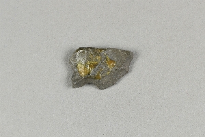
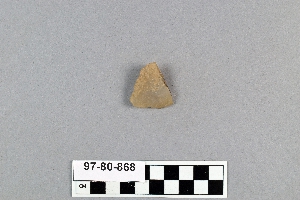
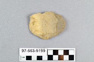
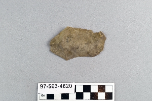
- chipped[24]

1 - 32 of 234 Records