Search Collections
- Object[315]
- no[315]
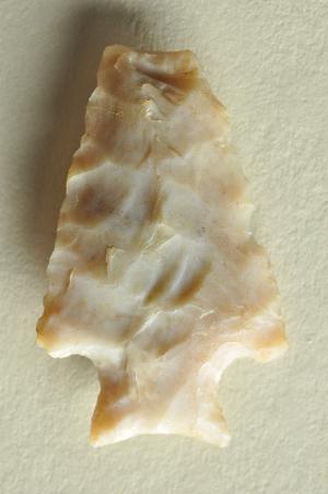
- american[315]
- point[315]
- adams county (mississippi)[4]
- albany county[1]
- anderson lake[15]
- apache canyon[3]
- arizona[1]
- bailey county[1]
- beck forest lake[19]
- berks county[3]
- big timber creek[9]
- bucks county[34]
- catawba river[11]
- clarksboro[3]
- clovis[52]
- connecticut[1]
- cumberland county (tennessee)[17]
- de kalb county (georgia)[1]
- decatur[1]
- delaware[1]
- duboistown[3]
- east greenwich township[3]
- east tennessee[11]
- eastern united states[3]
- eddy county[1]
- florida[5]
- floyd county (georgia)[1]
- garrett[2]
- georgia[64]
- gloucester county[13]
- gordon county[4]
- grassy cove[17]
- gravel pit[11]
- hans hoch's fields[1]
- harding county[7]
- high shoals[11]
- illinois[5]
- iredell county[21]
- lake[5]
- lancaster county (pennsylvania)[9]
- leon county[1]
- liberty county[58]
- live oak peninsula[7]
- locust grove[6]
- loudonville[1]
- luzerne county[1]
- lycoming county[3]
- maine[1]
- manatee county[1]
- maryland[2]
- mercer county[1]
- miniosa draw[6]
- mississippi[4]
- missouri[1]
- mora county[3]
- muerto creek[7]
- natchez[4]
- near bueyeros[7]
- near carlsbad[1]
- near dalhart[3]
- near levy[3]
- near nara visa[6]
- near pasamonte[1]
- near san jon[2]
- near taos[2]
- near tecolote[2]
- near tucumcari[2]
- new jersey[14]
- new mexico[79]
- new york[1]
- north carolina[34]
- ohio[1]
- oley[2]
- pechoqueolin creek[8]
- pennsylvania[65]
- philadelphia[12]
- philadelphia county[12]
- pot creek[2]
- pricetown[1]
- prince george county[2]
- quay county[12]
- rattlesnake point[1]
- red fish point[1]
- rincon[2]
- rome (georgia)[1]
- salinas creek[3]
- san miguel county[2]
- south fork[11]
- st. charles bay[2]
- tallahassee[1]
- tampa bay[2]
- taos county[2]
- tennessee[7]
- texas[14]
- trenton[1]
- troutman ranch[2]
- united states of america[236]
- wisconsin[1]
- pueblo[1]
- blow-out[1]
- camp site[2]
- embedded in sand[1]
- first terrace surface[2]
- found near mammoth bone[1]
- from lake 3 mi. w. of gravel pit near clovis, n.m.[1]
- just above mammoth tusk[1]
- lake 15 mi. west[2]
- near hearth[1]
- near mammoth tusk[1]
- sand "blowout" 20-25 miles northeast of carlsbad[1]
- surface[7]
- surface in blown area[3]
- west side of gravel pit[1]
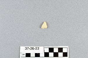
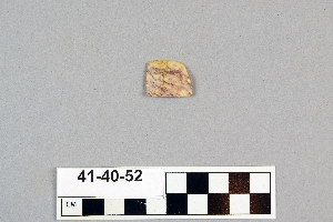
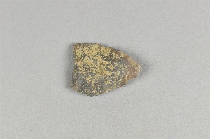
- chert[315]
- chipped[315]

1 - 32 of 315 Records