Search Collections
- Object[497]
- no[497]
- american[496]
- near eastern[1]
- flake[1]
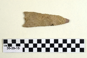
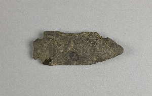
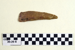
- knife[497]
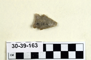
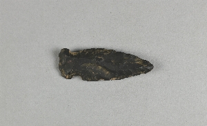
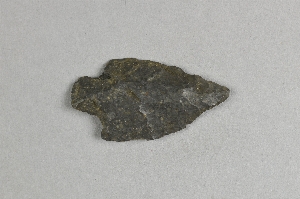
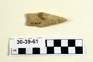
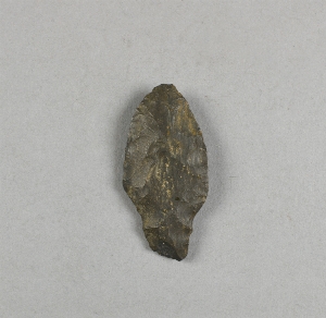
- projectile point[181]
- scraper[1]
- spear point[1]
- abilene[3]
- adams county (mississippi)[2]
- albany county[4]
- albany region[4]
- allegheny county (pennsylvania)[1]
- anderson lake[13]
- auglaize county[1]
- beck forest lake[3]
- berks county[10]
- beth shean[1]
- bethlehem (pennsylvania)[1]
- big timber creek[1]
- blowout mountain[8]
- boone county[1]
- burke county[4]
- california (state)[11]
- charlestown township[1]
- chattanooga[2]
- chester county[1]
- chickies[1]
- chillicothe[11]
- clovis[7]
- cumberland county (tennessee)[3]
- curry county[1]
- diamond (ohio)[33]
- duke (north carolina)[2]
- east orland[11]
- east tennessee[19]
- eastern pennsylvania[5]
- eastern united states[2]
- eddy county[5]
- elgin[176]
- elm creek[3]
- ewing and bragdon site[23]
- farm of william holocher[4]
- floyd county (georgia)[3]
- fort duquesne[1]
- frenchman's bay[23]
- georgetown[1]
- georgia[7]
- gloucester county[1]
- grassy cove[3]
- gravel pit[2]
- green river[2]
- guadalupe (california)[6]
- gulf of mexico[2]
- hancock county (maine)[34]
- hans hoch's fields[2]
- high terrace[3]
- huron county[1]
- illinois[3]
- israel[1]
- jefferson parish[1]
- jersey county[1]
- kentucky[6]
- knox county (tennessee)[1]
- knoxville[1]
- lancaster county (pennsylvania)[4]
- lebanon[1]
- lehigh county[5]
- lehigh river[1]
- little pine canyon[3]
- locust grove[2]
- louisville[1]
- maine[34]
- marshall county (west virginia)[2]
- mississippi[2]
- missouri[3]
- natchez (mississippi)[2]
- near abilene[11]
- new jersey[10]
- new mexico[27]
- new york[4]
- north carolina[2]
- nueces county[2]
- ohio[97]
- ohio county (west virginia)[2]
- padre island[2]
- palmyra township[33]
- pennsylvania[65]
- pimatella ranch[6]
- portage county[34]
- pricetown[9]
- railroad mountain[2]
- ralph thayer ranch[3]
- rocky arroyo[2]
- rome (georgia)[3]
- ross county[14]
- san nicolas island[4]
- santa barbara county[6]
- shell bluff[4]
- site 5[2]
- site 8[13]
- tennessee[8]
- texas[194]
- united states of america[424]
- unites states of america[34]
- west virginia[2]
- wheeling[2]
- wyoming[3]
- early bronze i[1]
- early bronze ii[1]
- late archaic[11]
- maritime archaic[11]
- moorehead phase[11]
- basketmaker[1]
- red paint people[11]
- "johnny-behind-the-deuce cave"[3]
- 10 1/2" deep below 6 1/2" of ploughed area[1]
- 11" deep, 8" down in cr. shell[1]
- 11" from b.[1]
- 13 1/2" deep, in cr. shell and fire dirt;[1]
- 13" down in 16" band of shell over fire pit[1]
- 14" deep, heap 28" deep; 25" from c, 27" from 3[1]
- 14" from 7, 15" from c.[1]
- 15 1/2 from 7[1]
- 15" deep in cr. shell[1]
- 16 1/2" deep on top of ash and beach gravel and fine shell 5" deep[1]
- 16 1/2" from c, 19" from 1.[1]
- 16" from 3, 33 1/2" from c.[1]
- 17" deep in humus, beach gravel and fire dirt and shell, on top of basic clay[1]
- 17" deep, under ploughed area[1]
- 17" from d, 2" from 6[1]
- 18 1/4" from c.[1]
- 2 1/2" from 2[1]
- 2" from b, 13" from 4[1]
- 20" from c, 4 1/4" from 4[1]
- 21" down in 16" band of shell over fire pit[1]
- 22" deep in 1" of beach pebble below 2" of black ash at bottom of heap[1]
- 22" deep, under 17" of cr. shell, and 1" of b. gravel, in 1 1/2" of fine cr. shell and fire dirt[1]
- 22" from b, 6" from 6[1]
- 23" from c, 2 1/2" from 3.[1]
- 24" deep in bottom of cr. shell extending from top[1]
- 24" deep in whole and cr. shell 28" deep[1]
- 25" deep lying in fire dirt of hearth, beside hearth stone under 2" of pebble[1]
- 27 1/2" deep in 1 3/4" of beach gravel.[1]
- 27" deep below 2" stratum of beach gravel, in bl. fire dirt[1]
- 27" deep, heap 32" deep here over band of cr. shell[1]
- 3" deep over fire dirt 3 3/4" deep; 7" from 2, 14" from a.[1]
- 4 1/2" from b[1]
- 5 3/4" deep in bottom layer of beach gravel and shell[1]
- 5" from 3, 30" from b[1]
- 6" deep in whole and cr. shell; 1" from c. 16 1/2" from 1[1]
- 8" from 7[1]
- `3" deep. 2" down in 16" of whole and cr. shell; 17" from b, 6" from 10[1]
- above fire dirt and beach gravel, heap 31" deep;[1]
- basin site[1]
- creek bed of elm creek 7.5 mi. south of abilene[3]
- flying moose lodge boys camp (est. 1921)[11]
- found in neighborhood of elgin[1]
- from "blow-outs" near finley site, near eden[1]
- from lake bank 1 mi. s.e. of gravel pit near clovis, n.m.[1]
- from roadside gutter[1]
- heap 28 1/2" deep[1]
- heap 28"[1]
- jim armstrong farm[1]
- just above humus; 11" from 14, 26 1/2" from c.[1]
- on 15, 23" from b[1]
- on c line, 5 1/2" from 3.[1]
- on line o, 21" from 15.[1]
- rowland's farm[1]
- sand dune surface site near nugent[1]
- surface[11]
- surface site[8]
- walled cave rocky arroyo seep 50-60 miles west of carlsbad[1]
- chipped[497]
1 - 32 of 497 Records