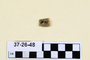
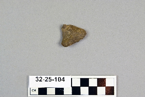
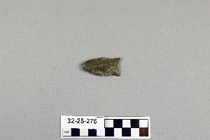
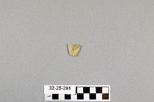
Search Collections
- Object[247]
- no[247]
- american[246]
- near eastern[1]
- point[247]
- alibates creek[1]
- anderson lake[3]
- beck forest lake[1]
- berks county[27]
- beth shean[1]
- big timber creek[6]
- bivens estate ranch[1]
- blowout mountain[1]
- boone county[13]
- bridgeport[1]
- bucks county[12]
- burke county[3]
- cairo[1]
- canadian river[1]
- clovis[17]
- cumberland county (tennessee)[6]
- curry county[1]
- de kalb county (georgia)[1]
- decatur[1]
- delaware valley[1]
- east tennessee[3]
- eastern united states[7]
- eddy county[2]
- elgin island[1]
- elm creek[1]
- ewing and bragdon site[57]
- florida[3]
- floyd county (georgia)[14]
- frenchman's bay[57]
- georgia[30]
- gloucester county[10]
- gordon county[10]
- grassy cove[6]
- gravel pit[14]
- hancock county (maine)[56]
- hancock county (tennessee)[1]
- illinois[5]
- ingleside cove[2]
- israel[1]
- jersey county[2]
- kentucky[31]
- kincaid site[1]
- lancaster county (pennsylvania)[3]
- liberty county[2]
- little pine canyon[1]
- live oak peninsula[1]
- logan township[1]
- macoupin county[2]
- maine[57]
- mammoth cave[15]
- massac county[1]
- mercer county[1]
- metropolis[1]
- missouri[1]
- monmouth county[6]
- monroe county (pennsylvania)[1]
- naples[1]
- near abilene[2]
- near san jon[1]
- near taos[2]
- new jersey[17]
- new mexico[27]
- nueces county[2]
- ohio[2]
- pennsylvania[46]
- philadelphia[1]
- philadelphia county[1]
- piasa[2]
- polard lake[3]
- pot creek[2]
- pricetown[4]
- quay county[1]
- ralph thayer ranch[1]
- rocky arroyo[1]
- rome (georgia)[14]
- salinas creek[2]
- shell bluff[3]
- site 10[3]
- site 8[2]
- southern california[1]
- st. charles bay[1]
- stoddartsville[1]
- taos county[2]
- tennessee[5]
- texas[8]
- trenton[1]
- united states of america[226]
- virginia[3]
- byzantine[1]
- early arabic[1]
- basket maker[1]
- pueblo[1]
- "johnny-behind-the-deuce cave"[1]
- 1 1/2" of ashes below, heap 24" deep[1]
- 1 1/2" of beach gravel and fire dirt[1]
- 10 1/2" deep in cr. shell[1]
- 10 3/4" from 3[1]
- 10" from 8[1]
- 11" deep in whole and cr. shell[1]
- 11" from a[1]
- 12" deep in cr. shell[1]
- 12" from 14[1]
- 13 1/2" from 3[1]
- 13" deep under 10" of whole and cr. shell, in narrow layer of fire dirt[1]
- 13" from c. 17" from 5[1]
- 14" from a[1]
- 14" from a.[1]
- 15" deep in cr. shell and fire dirt[1]
- 15" deep in finely cr. shells extending 20" down from top[1]
- 17 1/2" deep[1]
- 17 3/4" from c. on line 4[1]
- 17" deep in cr. shell area[1]
- 17" deep in whole and cr. shell 5 3/4" thick at bottom of heap.[1]
- 17" from c, 4" from 14[1]
- 18 1/2" from 5[1]
- 18 1/4" from c. 3 1/2" from 3[1]
- 18" deep below 10" of shell[1]
- 18" deep in 7 3/4" layer of b. gravel[1]
- 18" from d[1]
- 19" deep in whole and cr. shell to within 2 1/2" from bottom[1]
- 19" from c. 14 1/2" from 6[1]
- 2 1/2" down in 5 1/2" of cr. shell, ploughed[1]
- 2 1/2" from c.[1]
- 2 3/4" from 12.[1]
- 2 mi. w. of gravel pit near clovis, n.m.[2]
- 2" from bottom of whole and cr. shell and fire dirt[1]
- 2" of fire dirt, in 3" layer of beach pebble and fire dirt[1]
- 2" under a 6"" band of beach gravel[1]
- 20 1/2" deep[1]
- 20 1/2" deep in fine cr. shell all way down[1]
- 20 1/2" from 14.[1]
- 21 1/2" from c. 15" from 7[1]
- 21" deep down in band of cr. and whole shell[1]
- 21" deep in cr. shell from top to bottom[1]
- 22 1/2" deep in cr. shell and fire dirt,[1]
- 22" deep in cr. shell and fire dirt at bottom of heap[1]
- 22" down in stratus of fire dirt, fire, beach gravel, and shell[1]
- 23" deep in ash[1]
- 23" from 5[1]
- 24 1/2" deep under 5" of ploughed area[1]
- 24" from 5[1]
- 25" deep[1]
- 25" from c, 10" from 3[1]
- 26 1/2" from a[1]
- 27" deep in ash and fire dirt below pottery, at bottom of heap[1]
- 27" from d[1]
- 28" down in 5" band of fire dirt, beach gravel and cr. shell[1]
- 3 1/2" from 3[1]
- 3 3/4" from d.[1]
- 3" from 15[1]
- 3" from 3.[1]
- 3" from a[1]
- 30" deep in fireplace of black humus and fire dirt[1]
- 30" from c[1]
- 31 1/2" from d[1]
- 34" from c.[1]
- 36" from c. on b, 13 1/4 from 14[1]
- 5" above fire dirt and beach gravel[1]
- 5" of whole and cr. shell[1]
- 6 1/2" from 6[1]
- 6 1/4" deep; over cr. shells, fire dirt and replace; 26" from a, 14" from 12[1]
- 6" from a[1]
- 6" from d.[1]
- 7" down in cr. shell and grass roots;[1]
- 8 1/2" from 3[1]
- 8" deep[1]
- 8" down in 10 " of whole and cr. shell[1]
- 9 1/2" from a[1]
- 9" deep under 1 3/4" of pure ash[1]
- above 3" of fire dirt and ash; 7" from c, .4" from 4.[1]
- basin site[1]
- creek bed of elm creek 7.5 mi. south of abilene[1]
- fire dirt and cr. shell[1]
- first terrace surface[2]
- from 2 mi. w. of gravel pit near clovis, n.m.[1]
- from lake 3 mi. w. of gravel pit near clovis, n.m.[3]
- from old lake 1.5 mi. s.w. of gravelpit about 18 mi. s.w. of clovis[1]
- from old lake west of gravel pit about 18 mi. s.w. of clovis[4]
- heap 25 1/2" deep[1]
- heap 27" deep[1]
- heap 28" deep; 20" from a. 17" from 12.[1]
- humus and fire dirt 16 1/2" deep[1]
- on line 8[1]
- over pure ash and beach gravel[1]
- rectangular pit house, 2d/2b, 15 in. below surface -- at base of humus.[1]
- surface[1]
- surface around gravel pit near clovis, n.m.[2]
- surface site[1]
- under 1 3/4" of ash and shell and 6" of beach gravel, shell and fire dirt[1]
- walled cave rocky arroyo seep 50-60 miles west of carlsbad[1]
- west side of gravel pit[1]

1 - 32 of 247 Records