Search Collections
- Object[1,825]
- no[1,825]
- african[69]
- american[735]
- asian[4]
- egyptian[205]
- european[281]
- mediterranean[1]
- near eastern[473]
- oceanian[57]
- arrowhead[1]
- bead[1]
- blade[4]
- cast[5]
- chopper[1]
- drill point[1]
- flake[9]
- flake knife[1]
- flakes[1]
- grattoir[16]
- gunflint[4]
- hand axe[1]
- knife[43]
- knife blade[1]
- lithic[1]
- microliths[2]
- nodule[1]
- nucleus (lithic)[2]
- perforator[1]
- point[6]
- racloir[4]
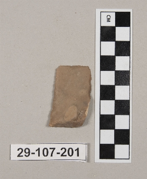
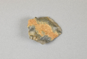
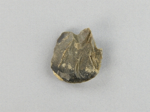
- scraper[1,825]
- spearhead[1]
- tablet[1]
- tool[7]
- abilene[23]
- abydos[6]
- alaska[73]
- alibates creek[16]
- anderson lake[14]
- antelope creek[19]
- australia[25]
- avenue farm[6]
- ballas[12]
- beck forest lake[8]
- beck row[6]
- belt cave[134]
- beth shean[98]
- bisitun[46]
- bivens estate ranch[11]
- blowout mountain[6]
- brownsville[6]
- buffalo gap[11]
- canadian river[65]
- charente[9]
- clovis[19]
- cottonwood creek (texas)[7]
- cumberland county (tennessee)[6]
- deal[10]
- diamond (ohio)[8]
- dordogne[29]
- east tennessee[27]
- egypt[205]
- el-mahasna[18]
- elm creek[57]
- england[113]
- europe[112]
- ewing and bragdon site[39]
- florida[8]
- forest heath district[84]
- france[53]
- frenchman's bay[39]
- gau ade[60]
- gould ruin[18]
- grotte des carnassiers[10]
- hancock county (maine)[39]
- handley ranch[22]
- indian hill[23]
- indiana[8]
- iran[202]
- iraq[22]
- israel[97]
- kenya[60]
- kermanshah province[46]
- kings ruins[12]
- ksar akil[120]
- laguna madre island[8]
- landergin[29]
- lebanon[120]
- lendsey farm[29]
- maine[39]
- mathews ranch[9]
- mit-rahineh[142]
- mugharet el wad[18]
- mulka station[7]
- naqada[18]
- near abilene[163]
- near albany[9]
- near clovis[11]
- new mexico[63]
- north riding[7]
- north stow[30]
- nueces county[9]
- ohio[45]
- palestine[21]
- palmyra township[8]
- pennsylvania[25]
- pickering[7]
- point barrow[8]
- point barrow region[27]
- point hope[31]
- port phillip bay[10]
- portage county[8]
- quay county[10]
- reijiba[14]
- rockport[9]
- rosson's ranch[11]
- solomon islands[32]
- south africa[8]
- south australia[7]
- southeastern australia[10]
- susa (iran)[8]
- tal-i-bakun[11]
- tennessee[12]
- texas[381]
- united states of america[650]
- unites states of america[8]
- ur[15]
- utkiavik[10]
- utkiavin[15]
- vallon des rebieres[10]
- weather hill[15]
- wolf creek[22]
- wyatt farm[26]
- yorkshire[7]
- african paleolithic period[1]
- aurignacian[5]
- billa iv[1]
- byzantine[3]
- central california phase[4]
- chalcolithic[17]
- early arabic[3]
- early bronze age[1]
- early bronze i[9]
- early bronze ii[17]
- early bronze iv[4]
- early horizon[4]
- early iron age[6]
- egyptian early dynastic[6]
- egyptian predynastic period[22]
- first dynasty[6]
- halaf period[2]
- hellenistic[2]
- historic[4]
- iron age ia[6]
- iron age ib[8]
- iron age iia[5]
- iron age iib[3]
- jomon[3]
- late bronze ib[11]
- late bronze iia[11]
- late bronze iib[5]
- lower mousterian[6]
- magdalenian[1]
- middle acheulian[1]
- middle aurignacian[1]
- middle bronze i[4]
- middle bronze iib[1]
- middle bronze iic[1]
- middle horizon[4]
- middle paleolithic[3]
- modern[1]
- mousterian[69]
- neolithic[143]
- old kingdom[2]
- paleolithic[1]
- roman[2]
- roman period[1]
- solutrean[1]
- third dynasty[3]
- upper levallois[3]
- upper paleolithic[4]
- atlitian[2]
- aurignacian[5]
- cherokee[3]
- eskimo[47]
- indian[1]
- iroquois[4]
- japanese[3]
- jomon[3]
- lower aurignacian[2]
- lower mousterian[6]
- magdalenian[1]
- middle acheulian[1]
- middle aurignacian[19]
- mousterian[127]
- neolithic[121]
- paleolithic[1]
- prehistoric[1]
- prehistoric eskimo[24]
- pueblo[1]
- roman[1]
- solutrean[1]
- thule[2]
- upper levallois[4]
- upper paleolithic[4]
- wangkangurru[7]
- wardaman[3]
- woodland[1]
- 0.75 mi beyond bridge[4]
- 0.75 mi. beyond bridge[22]
- 200.12[7]
- 200.13[3]
- 200.14[2]
- 200.16[4]
- 200.17[7]
- 200.18[5]
- 200.19[3]
- 200.20[2]
- 200.3[2]
- 200.6[3]
- 200.7[2]
- 200.8[3]
- 200:12[3]
- 350[2]
- 380[3]
- 440[2]
- 450[3]
- 460[6]
- 6 miles below handley ranch[3]
- anderson lake, about 15 mi. s.e. of clovis, n.m.[12]
- box #12[2]
- box #13[20]
- box #19[15]
- box #6[7]
- c2[3]
- callo del oso[2]
- camp site[2]
- central fort[2]
- centre line[9]
- chateau malbarret[5]
- desert[2]
- dr. ray's site on clear fork of brazos river[2]
- elm creek surface site[25]
- field 337[2]
- first terrace surface[4]
- from "blow-outs" near finley site, near eden[2]
- gravel pit[11]
- house 119[2]
- ixb[2]
- ixd[5]
- ixe[3]
- ixf[5]
- level 10[3]
- level 11[9]
- level 12[19]
- level 13[15]
- level 14[14]
- level 15[9]
- level 16[3]
- level 17[7]
- level 20[2]
- level 24[5]
- level 25[4]
- level 26[2]
- level 27[2]
- level c[3]
- level d[2]
- level d 1[4]
- level d 2[8]
- level e[13]
- level f[34]
- lower mousterian level[5]
- mesa site[6]
- near mouth of elm creek[26]
- paint creek[25]
- region around rockport[8]
- rm100[9]
- rm101[9]
- rm110[5]
- rm140[8]
- rm160[3]
- rm170[3]
- rm180[4]
- rm200.1[3]
- rossen's ranch near lawn[11]
- ruin along ancient ditch near englewood[3]
- sand site[9]
- site 2 - 18 degrees 47' 44" n, 47 degrees 06' 35" e[3]
- surface[41]
- surface near deal[9]
- surface site[37]
- surface site in cotton field 1 mi. e. of lawn[3]
- surface site in cotton field mile e. of lawn[11]
- surface site near abilene[13]
- tomb of anedjib (tomb x)[5]
- viiic[5]
- xa[10]
- xb[4]
- xc[7]
- xia[10]
- xib[5]
- xii[3]
- xixa[8]
- xvi[8]
- xvii[11]
- xviii[19]
- xxiii[3]
- xxx[3]
- chipped[232]
- flaked[3]
- retouched[1]
- unfinished[1]
- worked[4]
- actual citation[35]
- type citation[1]
1 - 32 of 1,825 Records

