Search Collections
- Object[1,010]
- no[1,010]
- american[1,002]
- asian[1]
- egyptian[6]
- near eastern[1]
- bowl[1]
- cup[1]
- dipper fragment[1]
- dipper handle[1]
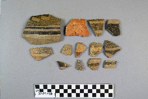
- sherd[1,010]
- vessel[1]
- altar de sacraficios[113]
- arizona[314]
- balanced rock[71]
- bates road[2]
- chaco canyon[11]
- chama (guatemala)[1]
- citadel pueblo[10]
- clovis[4]
- colorado[247]
- department of peten[115]
- dra abu el-naga[4]
- duncan (arizona)[68]
- eastern arizona[1]
- eddy county[7]
- egypt[6]
- fanny jones ranch[2]
- forbidden canyon[8]
- gilson canyon[1]
- guatemala[116]
- india[1]
- iran[1]
- kalibangan[1]
- keetzeel[53]
- kroenig ranch[1]
- la luz[1]
- last chance canyon[1]
- lincoln national forest[1]
- little colorado area[2]
- little colorado culture area[126]
- little colorado region[45]
- live oak peninsula[1]
- maljamar[8]
- mancos[1]
- mesa[2]
- mesa verde district[25]
- mora river[2]
- navaho mountain[164]
- navajo reservation[250]
- near alamogordo[60]
- near carlsbad[4]
- near cortez[4]
- near la luz[15]
- new mexico[234]
- northeast arizona[2]
- northeastern arizona[2]
- otero county[75]
- owl house[78]
- pecos[1]
- placer county[1]
- pueblo bonito[1]
- pueblo mound[1]
- rajasthan[1]
- red house ruin[5]
- rio grande region[2]
- rocky arroyo[1]
- san juan area[10]
- san juan culture area[75]
- sandrock cave[1]
- second jernada site[5]
- site 2[12]
- site 3[1]
- site 4[2]
- southeastern utah[3]
- southwest colorado[3]
- southwest united states[1]
- st. george[2]
- tal-i-bakun[1]
- tecolote[32]
- texas[1]
- tsebanahatci[78]
- tsegi canyon[1]
- tsegie river[7]
- united states of america[112]
- upper gila area[5]
- upper rocky arroyo[2]
- utah[261]
- watrous[4]
- willard[21]
- wupatki pueblo[14]
- prehistoric[43]
- pueblo iii[1]
- anasazi[62]
- cliff dweller[189]
- cliffdweller[241]
- gila[1]
- pre-harappan[1]
- prehistoric[13]
- prehistoric pueblo[70]
- pueblo[141]
- sothi[1]
- zuni[2]
- central american[116]
- southwest culture area[886]
- "from gravels as deep in side of bank as 6' 5". trail cut along side in 1934, 5 ft. wide. pottery sherds in 17" deeper."[6]
- "mound" - adobe walls[5]
- 0.25 mi. from b., below rock wall, on top of valley sediments[35]
- 100 yds. nne of section a, top of unconsolidated valley deposit[7]
- cliff-house in side canyon of forbidden canyon[7]
- cliff-house in side of canyon[1]
- found in cave on side of mesa east of mountain[1]
- from gravel bank about 200 yards e. n.e. of kim, depth 18"[3]
- from gravel bank about 200 yards e. n.e. of kim, depth 32"[2]
- from gravel bank about 200 yards e. n.e. of kim, depth 38"[1]
- mound a, top digging[1]
- north mesa[1]
- prescott 2:3, 2:23 (gladwin classification)[1]
- pueblo bonito[1]
- sand "blowout" 20-25 miles northeast of carlsbad[2]
- site 40 or 41[1]
- small cave on side of mesa[1]
- surface[1]
- surface collection[58]
- surface find[1]
- surface finds[49]
- surface of gully in front of rim.[4]
- surface, rocky arroyo, near bates road west carlsbad, n.m.[1]
- walled cave rocky arroyo seep 50-60 miles west of carlsbad[1]
- hathor[1]

1 - 32 of 1,010 Records