Search Collections
- Object[91]
- american[87]
- egyptian[1]
- mediterranean[3]
- alaska[59]
- aleutian islands[2]
- anderson bay[1]
- angiluk[1]
- atka island[1]
- baillie island[1]
- big diomede island[2]
- canada[23]
- cape denbigh[4]
- cape fullerton[1]
- cape prince of wales[2]
- cape starichkof[1]
- carthage[1]
- chenega island[1]
- cockburn point[5]
- cook inlet[3]
- coppermine river[1]
- coronation gulf[1]
- cottonwood creek (alaska)[1]
- crete[2]
- diomede island[1]
- diyaguna'et[1]
- east cape[2]
- egypt[1]
- ehnasya[1]
- ellamar[1]
- esther passage[1]
- ewan bay[1]
- fox farm[2]
- fury and hecla strait[1]
- gournia[1]
- greece[2]
- gulf of boothia[4]
- hinchinbrook island[1]
- iyatayet[4]
- kachemak bay[1]
- kayak island[1]
- kenai[2]
- kenai peninsula[1]
- kimiklik village[1]
- king island[1]
- knight island[9]
- labrador[1]
- lost river[1]
- mackenzie river[1]
- mummy island[1]
- northwest territories[8]
- norton sound[4]
- nunavut[1]
- old town[9]
- paddy bay[1]
- palu:tat[2]
- point barrow[1]
- point hope[1]
- port graham[2]
- prince william sound[3]
- pseira[1]
- repulse bay[1]
- shemya island[1]
- siberia[4]
- smith's fox farm[2]
- tunisia[1]
- unalakleet[10]
- united states of america[35]
- victoria land[6]
- wainwright[1]
- yakutat bay[10]
- yukon island[7]
- zeugitana[1]
- aleut[2]
- eskimo[15]
- inuit[4]
- kachemak bay culture iii[2]
- minoan[2]
- paleo-eskimo[3]
- prehistoric eskimo[6]
- roman[1]
- tanaina[1]
- tulare[1]
- yakutat (culture)[5]
- 14" deep in midden.[1]
- 4' 6"[1]
- 4'9" - 5'6"[1]
- 5 h, 10' 3" - 10' 9". at the side of a hole dug into layer 1 from layer 1 from layer 5-a.[1]
- 5' 4" - 5' 9"[1]
- 9 ' below surface[1]
- beach on northeast point[1]
- c + d, 3' - 3'3"[1]
- d, 4' 9" - 5', vii[1]
- e 4' 4" - 6', vii (in loose shells)[1]
- found in an abandoned house.[1]
- found on cannery site, probably from old village of sustin[1]
- gun.[3]
- house 119[4]
- house 120[3]
- house 2[1]
- house 3[1]
- house pit #1 - depth 21"[1]
- house pit 1 fill, light brown ashy sand[1]
- ip house[1]
- iym[1]
- j[1]
- k 1' 6"-2'[1]
- layer 4, 5, or 5a?[1]
- layer 7?[1]
- midden.[1]
- mound b - depth 21"[1]
- mound b - upper level, depth 10"[1]
- mound b, light brown ashy sand[1]
- mouth of river[1]
- n 2.5, w 2 - wall continuation[1]
- s 4.5, w 1.5 - floor[1]
- marble (stone)[1]
- sandstone[1]
- steatite[1]
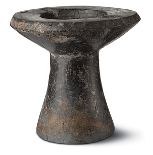
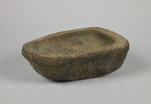
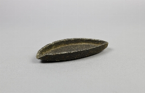
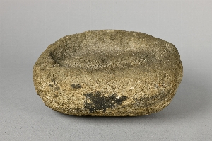
- stone[91]
- ground stone[9]
- igalaaq[1]

1 - 32 of 91 Records