Search Collections
- Object[1,284]
- american[1,284]
- adze[4]
- amulet[4]
- anvil[3]
- argillite[3]
- arrow point[4]
- arrow shaft straightener[1]
- arrowhead[42]
- arrowheads[4]
- axe[122]
- axe fragment[2]
- ball[2]
- banner stone[1]
- bannerstone[47]
- basketry[1]
- blade[10]
- boulder (stone)[5]
- celt[40]
- ceremonial object[7]
- ceremonial stone[4]
- charm stone[1]
- chip[1]
- chips[1]
- chisel[1]
- club head[5]
- cup[2]
- dagger[1]
- dice[1]
- disc[3]
- disk[1]
- drill[20]
- drill stem[1]
- flake[16]
- flakes[2]
- fragment[1]
- fragments[1]
- gorget[14]
- gorget fragment[1]
- gouge[9]
- grinding stone[2]
- grooved axe[7]
- hammer[38]
- hammer-stone[5]
- hammerstone[44]
- hammerstones[4]
- hatchet[1]
- hoe[3]
- implement[81]
- implements[2]
- jasper[1]
- knife[90]
- knives[1]
- lance head[3]
- lap-stone[1]
- lithic[8]
- mortar[4]
- muller[1]
- net sinker[12]
- net-sinker[2]
- object[8]
- ornament[3]
- paint stone[1]
- pebble[63]
- pebbles[4]
- pendant[7]
- perforator[1]
- pestle[61]
- pipe[1]
- pipe bowl[2]
- plate[1]
- plummet[5]
- point[110]
- point fragment[3]
- polisher[1]
- polishing stone[1]
- pot[1]
- potsherds[1]
- projectile point[194]
- projectile points[5]
- quern[2]
- rock[1]
- rubbing stone[11]
- rubbing-stone[3]
- scraper[30]
- scrapers[1]
- shaft scraper[1]
- sharpening stone[1]
- sherd[4]
- sinker[3]
- spade[5]
- spearhead[10]
- spearheads[3]
- statue[1]
- stone[48]
- stone fragment[6]
- stones[2]
- tablet[1]
- teshoa[1]
- whetstone[2]
- worked stone[2]
- workshop block[2]
- abbott farm[2]
- alloway's creek[3]
- assiscunk creek[1]
- atlantic county[2]
- bartlett shellheap[3]
- bartlett shellheep[4]
- belvidere[6]
- bergen county[1]
- big timber creek[19]
- billingsport[2]
- bordentown[11]
- bridgeport[1]
- bridgeton[1]
- burlington[4]
- burlington county[452]
- burlington island[39]
- camden (new jersey)[11]
- camden county[35]
- catawba (new jersey)[1]
- chestnut neck[1]
- choptank river[1]
- clark's pond[3]
- colts neck[1]
- cooper's creek (new jersey)[7]
- crosswick creek[8]
- cumberland county (new jersey)[7]
- delaware[1]
- delaware river[3]
- delaware river region[1]
- delaware valley[84]
- delaware water gap[27]
- east hanover[46]
- edgewater park[3]
- englewood (new jersey)[1]
- fairfield[3]
- fairton[3]
- fairview[1]
- fancy hill[2]
- farmingdale[4]
- freehold[2]
- glassboro[1]
- gloucester[3]
- gloucester county[80]
- greenwich township[1]
- haddonfield[5]
- haddonfield pike[1]
- hamilton[59]
- hamilton square[59]
- hammonton[11]
- holland[2]
- hunterdon county[6]
- illinois[1]
- indian mills[3]
- inskip[2]
- inskip region[11]
- kaighn's point[2]
- lambertville[6]
- laurie's mill pond[2]
- little timber creek[1]
- lumberton[75]
- mantua creek[1]
- maryland[1]
- medford[26]
- medford lake[2]
- mercer county[451]
- michigan[1]
- middlesex county (new jersey)[2]
- monmouth county[8]
- moorestown[155]
- morris county[5]
- mount ephraim[1]
- mount laurel[4]
- mouth of crosswicks creek[1]
- near rancocas creek[18]
- near trenton[3]
- new brunswick (new jersey)[2]
- new jersey[1,284]
- newbold island[1]
- newton creek[7]
- ocean county[4]
- othello[1]
- pennsylvania[7]
- plainfield[2]
- plainfield area[3]
- prospect[13]
- rancocas creek[108]
- raritan river[2]
- red bank (new jersey)[1]
- salem county[5]
- shamong township[4]
- somerset county[2]
- swedesboro[2]
- thorofare[1]
- timber creek[1]
- trenton[385]
- union county (kentucky)[1]
- union county (new jersey)[4]
- united states of america[1,278]
- warren county (new jersey)[33]
- woodport[5]
- hunterdon county[1]
- lenape[1]
- new jersey[1]
- paleolithic[1]
- "bottom level"[78]
- "intermediate level"[4]
- "lowest level"[24]
- abbott farm[2]
- banks of laurie's mill pond[7]
- bed of stream[1]
- berkley[1]
- brook near the site of the old tetona church[1]
- crispin (?) farm mound[1]
- driveway[1]
- farm[2]
- from meadows below trenton.[7]
- from surface of field.[2]
- gravel bluff facing delaware river below trenton[1]
- gravel surface of upper end of island.[2]
- gravelly field, surface[1]
- gravelly shore of moon's island, 1.5 miles below trenton nj[1]
- graves[1]
- hanover neck[46]
- interior of island, under deposit of sand, which rests on gravel such as is seen on shore of island, and bed of river.[1]
- laurie's mill pond[2]
- loose gravel.[1]
- metuchen[1]
- mound[1]
- mound near creek, "bottom level"[3]
- mound near rancocas creek[12]
- mound near rancocas creek; "bottom level"[2]
- mound near rancocas creek; "intermediate level"[9]
- property at 1735 kings highway[1]
- richard jordan house[1]
- sand dune in meadow[2]
- sapp sheelheap[1]
- sapp shellheap[2]
- squankum[4]
- surface[21]
- surface of "trenton gravel"[1]
- surface of field[4]
- surface of trenton gravel[1]
- talus. river bank.[1]
- these were found in a small heap, deeply buried under recent mud deposit; resting on white sand[1]
- this from gravel thrown out in digging sewer trench in center street.[2]
- west creek shellheap[2]
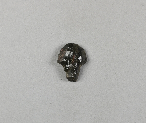
- animal head[1]
- human face[1]
- ceramic[2]
- peach pit[1]
- plant fiber[1]
- quartz[1]
- stone[1,284]
- carved[1]
- chipped[396]
- grooved[65]
- ground[43]
- ground stone[4]
- groundstone[30]
- incised[1]
- notched[1]
- pecked[3]
- pitted[2]
- polished[5]
- sherd[5]
- smoothed[2]
- unfinished[9]
- worked[2]
- actual citation[53]
1 - 32 of 1,284 Records


1 - 32 of 1,284 Records