Search Collections
- Object[105]
- no[105]
- american[105]
- alaska[24]
- aleut village[1]
- aleutian islands[2]
- alibates creek[2]
- aquanchicola creek[1]
- arizona[2]
- attu island[2]
- bivens estate ranch[2]
- bristol (pennsylvania)[1]
- bucks county[5]
- burlington county[3]
- burlington island[1]
- cape darby[3]
- cape nome[4]
- charlton county[2]
- chesser's island[2]
- chickies[5]
- colorado[3]
- cook inlet[5]
- cottonwood creek (alaska)[2]
- cumberland county (tennessee)[1]
- delaware county (pennsylvania)[2]
- delaware river[1]
- delaware valley[1]
- dutch harbor[1]
- east tennessee[1]
- georgia[2]
- grassy cove[1]
- gungnuk site[3]
- gunpowder neck[1]
- halibut cove[1]
- hammonton[4]
- hancock county (ohio)[1]
- harford county[1]
- inskip region[4]
- iredell county[1]
- ishmailoff island[1]
- kachemak bay[2]
- kansas[1]
- klickitat county[4]
- lancaster county (pennsylvania)[5]
- laurel hill cemetery[1]
- lehigh county[1]
- little mike point[2]
- lone wolf creek[2]
- lumberton[1]
- mancos[1]
- markham[2]
- marquette county[1]
- marshall county (west virginia)[2]
- maryland[1]
- mercer county[8]
- middlesex county (new jersey)[1]
- moorestown[1]
- morgantown road[20]
- near englewood[1]
- new brunswick (new jersey)[1]
- new jersey[16]
- new mexico[1]
- north carolina[1]
- norton sound[3]
- ohio[5]
- pechoqueolin creek[3]
- pennsylvania[36]
- philadelphia[1]
- philadelphia county[1]
- point pleasant[1]
- rancocas creek[1]
- raritan river[1]
- rock retreat[3]
- somerset county[1]
- southeast coast (alaska)[2]
- southern illinois[3]
- susquehanna valley[1]
- texas[4]
- trenton[8]
- unalaska island[1]
- united states of america[105]
- utah[2]
- washington (u. s. state)[4]
- washington boro[1]
- west virginia[3]
- wheeling[2]
- wheeling quadrangle[2]
- wisconsin[1]
- york county (pennsylvania)[1]
- yukon island[11]
- aleut[3]
- ancestral pueblo[2]
- chinook[4]
- eskimo[4]
- paleo-eskimo[3]
- prehistoric eskimo[5]
- "bottom level"[1]
- 2 f, 3' - 3' 6", viii (ix?)[1]
- 2 g, 3' - 3' 6", vii or viii[1]
- 2 m 2', ix[1]
- 3 e 6', ii[1]
- 4 k, 11' 6" - 12', layer 1 (?)[1]
- 5 j, 12' 6" - 13', layer 1[1]
- 5 k, 12' - 12' 6", layer 1[1]
- 5 k, 12' 6" - 13', layer 1[1]
- c, 3' - 3' 9", vii[1]
- c, 3' 9" - 4' 3", vii[1]
- d, 4' - 4' 6", vii[1]
- from potato patch, #4 square, west extension.[1]
- from road cut[3]
- from roadside gutter[14]
- from roadside gutter.[3]
- from ruin along ancient ditch[1]
- gun.[3]
- h, 10' 6" - 12', i[1]
- h, 3' - 3'6", vi[1]
- house 12[1]
- house 18[2]
- house 300[1]
- layer 10 ft. below surface.[1]
- mound i[1]
- nutbeam's beach[1]
- village site is 1/2 mile southwest of dutch harbor[1]
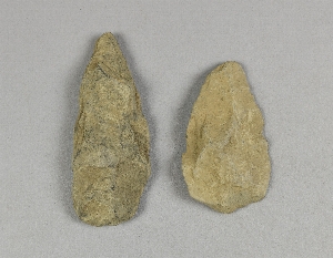
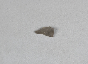
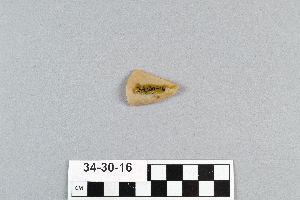
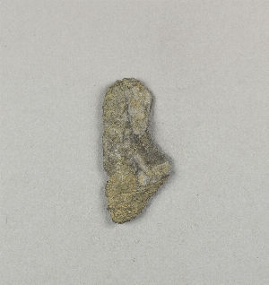
- chipped[63]
1 - 32 of 105 Records
1 - 32 of 105 Records