Search Collections
- Object[619]
- no[619]
- african[1]
- american[446]
- asian[29]
- egyptian[2]
- european[28]
- mediterranean[1]
- near eastern[5]
- oceanian[107]
- alaska[70]
- alibates creek[5]
- anderson lake[2]
- arizona[8]
- australia[98]
- banquete creek[4]
- baousse-rousse caves[2]
- berks county[11]
- beth shemesh[2]
- bivens estate ranch[5]
- bolivia[11]
- boyertown[11]
- brackettville[2]
- breckenridge county[2]
- bucks county[16]
- burlington county[2]
- burma[12]
- california (state)[29]
- cape prince of wales[4]
- chubu region[2]
- clinton county[7]
- clovis[6]
- colorado[10]
- cook inlet[5]
- corpus christi[7]
- culberson county[2]
- david rose's ranch[2]
- delaware water gap[10]
- diamond (ohio)[22]
- dordogne[6]
- europe[19]
- france[8]
- goradi[4]
- gravel pit[3]
- harding county[3]
- hokkaido[3]
- honshu[9]
- illinois[3]
- india[4]
- iredell county[3]
- japan[13]
- kachemak bay[3]
- kanagawa prefecture[7]
- kentucky[3]
- kittitas county[24]
- knight island[4]
- kyaukpadaung[11]
- live oak peninsula[6]
- lock haven[7]
- marshall county (west virginia)[53]
- mercer county[21]
- mexico (central america)[4]
- mississippi[3]
- monroe county (pennsylvania)[10]
- montgomery county (pennsylvania)[3]
- muerto creek[3]
- near bueyeros[3]
- near hobart[64]
- near wheeling[34]
- new jersey[30]
- new mexico[25]
- north carolina[6]
- northern australia[4]
- nueces county[14]
- nueces dam[7]
- ohio[36]
- ohio county (west virginia)[39]
- old town[4]
- palmyra township[22]
- pennsylvania[59]
- polard lake[5]
- portage county[22]
- pottstown[3]
- quay county[4]
- richmond (australia)[23]
- rincon[5]
- san diego county[29]
- san patricio county[7]
- site 10[5]
- solomon islands[9]
- southeastern australia[22]
- southeastern utah[3]
- tasmania[65]
- texas[44]
- torrey pines[21]
- trenton[21]
- unalakleet[50]
- united states of america[251]
- unites states of america[22]
- utah[7]
- victoria (australia)[23]
- viscachani[11]
- washington (u. s. state)[26]
- west virginia[54]
- western australia[3]
- wheeling[19]
- wheeling quadrangle[14]
- yakutat bay[4]
- yokohama[7]
- yukon island[3]
- kourion[1]
- eneolithic[2]
- jomon[13]
- kachemak bay culture iii[1]
- late cypriot iiib[1]
- late paleolithic[1]
- mesolithic[3]
- middle archaic[1]
- neolithic[1]
- paleolithic[1]
- paleolithic, japan[6]
- pre-sargonic[1]
- prehistoric[12]
- stroked phase[1]
- yayoi[6]
- algonquin[6]
- ancestral pueblo[5]
- athapaskan[2]
- ayampitin[11]
- chalchihuites[2]
- chinook[2]
- cliff dweller[3]
- cypriot[1]
- danubian culture[1]
- eskimo[9]
- indian[4]
- inuit[1]
- iroquois[4]
- japanese[10]
- jomon[13]
- knatana[1]
- late paleolithic[1]
- maya[1]
- mesolithic[1]
- neolithic[1]
- paleolithic[6]
- pecos cave dweller[2]
- prehistoric eskimo[1]
- salishan[24]
- sassanian[1]
- scraper-maker culture[5]
- sioux[1]
- tairona[1]
- tanaina[1]
- wardaman[4]
- yayoi[6]
- 1' below surface of midden at north beach.[1]
- 103.1ew 102.4ns[1]
- 2 ' below surface.[2]
- 2 mi. w. of gravel pit near clovis, n.m.[1]
- 4th grotto[2]
- 6' 10" - 7' 8"[1]
- abbott farm[1]
- anderson lake, about 15 mi. s.e. of clovis, n.m.[1]
- approximate 7' level near front of pit.[1]
- burnt mound[2]
- callo del oso[1]
- cemetary b[1]
- dr. ray's site on clear fork of brazos river.[1]
- found under ground[1]
- from "blow-cuts" near finley site, near eden; on surface[1]
- from roadside gutter[1]
- from rock shelter[1]
- from surface on flood plain of delaware river[1]
- gravel pit[1]
- hays stewart farm, operation ii, surface[2]
- house 102[1]
- house 119[3]
- house 120[14]
- house 2[6]
- house 2 entrance[1]
- house 3[2]
- house ruin above second bench above cannery.[1]
- ip house[22]
- jasper quarry[1]
- kinkaid site[1]
- ky 1[1]
- ky-1[10]
- lofland and gooden farms on either side of cor marsh ditch[2]
- mescal pit in small canyon north of dark canyon near carlsbad, n.m.[1]
- mound b[2]
- mound d[2]
- n 0, w 1.5 - house wall continuation[1]
- n 1, w 2.75 - on compacted gravel level which is continuation of house wall[1]
- n 4, w 5.25 - house floor near hearth[1]
- n 4.25, w 2.75 - on wall of eastern edge of house[1]
- n 4.5, w 7 - outside house in a loose red gravel level directly north of possible entrance way[1]
- n 5.25, w 4.25 - in house floor[1]
- n3.8, w4.4 - house fill[1]
- near jamshedpur[4]
- on side of cliff; "shell midden"[1]
- pasture, ball court, t (c)[1]
- pine station, quiggle farm, operation iii, pit no. g and h, -1 and -2. depth not recorded.[1]
- pit 2[1]
- pit 3[1]
- porch of house #1, level uncertain[1]
- race track surface[1]
- s 4.5, w 5.5 - in gray level[1]
- s 5, w 1 - test pit - bottom level of house floor[1]
- shaw's farm, mouth of pine creek, below lock haen on west branch pf susquehanna river, surface[2]
- shell mounds[1]
- site 45-ki-19[24]
- square c, layer e, in wood on west[1]
- surface[17]
- surface around gravel pit near clovis, n.m.[1]
- surface find[11]
- surface finds from top of the biological grade[1]
- test pit - in wall[1]
- tomb 12:n[1]
- top layer of midden.[1]
- top of the biological grade[1]
- vicinity, surface[2]
- willamette river[1]
- yg-9[1]
- agate[1]
- amethyst[1]
- animal[1]
- animal bone[1]
- barite[1]
- bitumen[1]
- bone[3]
- chalcedony[5]
- chert[4]
- fossilrock[1]
- fossilwood[11]
- igneous rock[2]
- jasper[1]
- metasediment[1]
- quartz[2]
- quartzite[1]
- rhyolite[1]
- sandstone[1]
- shale[1]
- slate[1]
- stone[619]
- wood[3]
- actual citation[22]
- type citation[4]
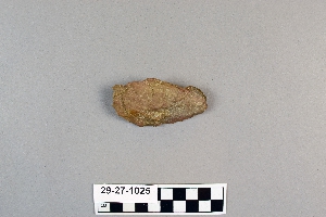
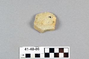
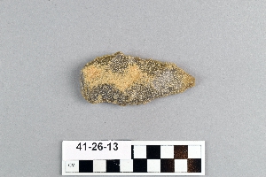
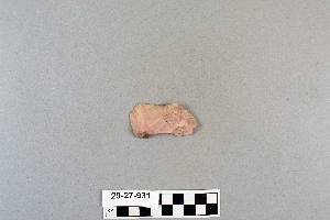
1 - 32 of 619 Records


