Search Collections
- Object[3,330]
- adze[10]
- adze blade[1]
- anchor[1]
- animal bone fragment[4]
- animal tooth[4]
- anvil[4]
- arrow point[5]
- arrow point fragment[1]
- arrowhead[319]
- arrowhead imitation[17]
- arrowheads[5]
- axe[241]
- axe head[3]
- ball[3]
- bannerstone[32]
- bead[11]
- beads[6]
- blade[27]
- blank[2]
- boat-stone[2]
- borer[5]
- boulder (stone)[2]
- celt[176]
- celt fragment[3]
- charcoal[6]
- chip[12]
- chips[4]
- chisel[5]
- club head[2]
- core[27]
- disc[7]
- discoidal[2]
- drill[31]
- end scraper[4]
- flake[36]
- flake scraper[2]
- flakes[2]
- gorget[20]
- gouge[7]
- grinding stone[2]
- grooved axe[21]
- hammer[20]
- hammer stone[2]
- hammers[2]
- hammerstone[144]
- hammerstones[3]
- hoe[11]
- implement[133]
- implements[3]
- knife[310]
- knives[29]
- lithic[15]
- lithic fragment[5]
- mollusk shell[5]
- mortar[12]
- muller[5]
- net sinker[233]
- object[14]
- object fragment[2]
- ornament[2]
- paint stone[3]
- pebble[127]
- pebbles[16]
- pendant[12]
- perforator[2]
- pestle[111]
- pestle fragment[4]
- pestles[2]
- pick-axe[8]
- pipe[3]
- pipe bowl[2]
- point[332]
- point fragment[4]
- points[2]
- polisher[6]
- pot fragment[11]
- projectile point[275]
- projectile point fragment[4]
- projectile points[53]
- reject[25]
- river stone[2]
- rubbing stone[21]
- scraper[59]
- sherd[19]
- side scraper[2]
- sinker[43]
- slab[2]
- slate[2]
- slickstone[3]
- spade[3]
- spear head[11]
- spearhead[55]
- stone[83]
- stone fragment[8]
- stones[2]
- tablet[4]
- tool[49]
- war club blade[9]
- whetstone[6]
- workshop fragment[10]
- allegheny river[43]
- bainbridge (pennsylvania)[34]
- beaver county[5]
- berks county[297]
- boyertown[250]
- bristol (pennsylvania)[30]
- bucks county[664]
- caldwell's island[4]
- chester county[26]
- chickies[70]
- clinton county[196]
- columbia (pennsylvania)[15]
- columbia county[4]
- conoy township[6]
- dauphin county[16]
- delaware county (pennsylvania)[42]
- delaware river[4]
- delaware valley[5]
- delaware water gap[484]
- dingman's ferry[4]
- doylestown[19]
- durham (us)[60]
- enterline[9]
- essington[7]
- fairmount park[6]
- flint quarry[37]
- forge island[6]
- fry's run[11]
- gaddis run[7]
- germantown[5]
- halls island[38]
- hansell farm[23]
- hokendauqua creek[4]
- hummel's wharf[27]
- irvine[43]
- johnson's creek[13]
- juniata county[7]
- keith manour[13]
- lancaster county (pennsylvania)[233]
- laurel hill cemetery[4]
- lehigh county[77]
- lewisburg region[7]
- limeport[23]
- lock haven[197]
- locust grove[8]
- long level[7]
- luzerne county[26]
- lycoming county[5]
- macungie[13]
- mahoning beach[14]
- marietta (pennsylvania)[4]
- markham[18]
- marshall's island[7]
- mckees island[9]
- mifflin[5]
- milford (pennsylvania)[59]
- monroe county (pennsylvania)[492]
- montgomery county (pennsylvania)[27]
- morgantown road[55]
- nescopeck[4]
- neshaminy creek[4]
- new hope[5]
- new jersey[7]
- northampton county[31]
- northeast[7]
- northumberland county[62]
- ohio[5]
- oley[4]
- pennsylvania[3,330]
- philadelphia[67]
- philadelphia county[70]
- phoenixville[4]
- pike county (pennsylvania)[68]
- pohopoco creek[30]
- point pleasant[238]
- pottstown[9]
- pulaski region[12]
- r. h. mohr's farm[9]
- raubsville[11]
- reading (pennsylvania)[15]
- riegelsville[100]
- rock retreat[27]
- sawmill creek[14]
- schuylkill county[9]
- siegfried's bridge[4]
- smithfield (pennsylvania)[7]
- snyder county[76]
- susquehanna river[80]
- susquehanna river valley[117]
- susquehanna valley[367]
- union county (pennsylvania)[8]
- united states of america[3,327]
- university of pennsylvania museum[4]
- vera cruz (pennsylvania)[5]
- wapwallopen[4]
- warren county (pennsylvania)[45]
- washington boro[41]
- witmer's farm[30]
- york[81]
- york county (pennsylvania)[112]
- early woodland period[2]
- historic[1]
- modern[1]
- paleolithic[15]
- algonquin[132]
- iroquois[90]
- late archaic[1]
- lenape[2]
- paleolithic[15]
- shawnee[1]
- sioux[1]
- susquehannock[5]
- northeast culture area[3,319]
- northeast culture area [4]
- "riverside"[3]
- 65th and girard avenues[1]
- along crum creek near chester[1]
- andalusia[1]
- bank of river[1]
- banks of the river[1]
- blockley field[1]
- brandywine (laudach) camp-site[1]
- charlestown township, rowland's farm[1]
- dr. evans lane[1]
- farm about 3 mi. above lock haven on south bank of west brnach of susquehanne river, surface.[4]
- field near town[2]
- flint quarry[11]
- found "in a field."[1]
- found in the under loam stratum.[1]
- found in the under loam structure.[1]
- frank moran's farm, surface[4]
- from ancient quarry[1]
- from ancient quarry.[2]
- from ancient shaft 11 ft deep[1]
- from ancient shaft 16 ft deep.[1]
- from around spring on top of hill near durham jasper quarry[8]
- from brandywine (laubach) camp-site.[33]
- from fire-place[16]
- from fire-place.[12]
- from road cut[6]
- from road side[1]
- from roadside gutter[39]
- from roadside gutter.[7]
- from rock shelter[2]
- from surface near pit.[2]
- from surface of leibhart-peters farm.[3]
- from surface on flood plain of delaware river[1]
- from talus.[1]
- from well near durham creek.[1]
- from workshop[2]
- from workshop.[4]
- fuller's hill[3]
- garden[1]
- golf links of the philadelphia country club[1]
- gravel exposure on jefferson avenue.[3]
- gravel pit[2]
- haldeman's garden[1]
- hays stewart farm, operation ii, surface[15]
- hereford?[7]
- in character, but not found in gravel[17]
- in lower loam stratum with charcoal.[1]
- in susquehanna river[6]
- in the sand stratum or at its base[1]
- independence square[1]
- indian blade workshop[1]
- indian village site[1]
- indian village site on old keith manour[13]
- jasper quarry[10]
- jasper quarry from large pit.[1]
- jasper quarry; surface[1]
- mckinney's farm, mouth of mcelhatten creek, south isde of west branch of susquehanna river, 4 mi. below lock haven. surface[2]
- miller farm, surface[3]
- miller's farm[1]
- monro farm, operation i, pit #26, depth 10 in[1]
- monro farm, operation i, pit #26, depth 7 in[1]
- monro farm, operation i, pit #26, depth 7-8 in[2]
- monro farm, operation i, pit #26, depth 7-9 in[1]
- monro farm, operation i, pit #26, depth 8 in[1]
- monro farm, operation i, test pit #1, depth 17 in[5]
- monro farm, operation i, test pit #2, depth 20 in[1]
- monro farm, operation i, test pit #26, depth 17 in[1]
- mr. snider's garden[1]
- near bottom of pit.[1]
- near chester[2]
- near parker's island bridge[1]
- near pine grove[1]
- near washington boro[1]
- on the delaware river opposite beverly nj[1]
- on the hill[1]
- one mile east of norristown[1]
- operation iii[3]
- operation iii, pit # 200[1]
- operation iii, pit # 200, section e -1[2]
- operation iii, pit # e and f, -3[4]
- operation iii, pit no. e and f, -3[2]
- opposite locust grove haldeman estate[6]
- pine station[15]
- pine station, quiggle farm, operation iii, pit no. e and f, -3. depth, surface to 14 in[2]
- pine station, quiggle farm, operation iii, pit no. g and h, -1 and -2. depth not recorded.[6]
- pine station, quiggle farm, operation iii, surface.[12]
- pit 200[4]
- protruding from bank of island, four feet from surface[2]
- quiggle farm[17]
- river bank[4]
- shaw's farm, mouth of pine creek, below lock haen on west branch pf susquehanna river, surface[29]
- surface[14]
- surface, neighborhood generally[5]
- van campen's island[2]
- vicinity, surface[60]
- village site and quarry[10]
- village site and quarry, very little burials.[191]
- west of morrisville, gravel[4]
- workshop in ancient quarry.[4]
- zimmerman's farm[2]
- animal[10]
- animal bone[3]
- animal tooth[4]
- argillite[8]
- bone[10]
- cement[4]
- ceramic[18]
- charcoal[6]
- clay[1]
- iron[1]
- jasper[9]
- limestone[1]
- metal[1]
- mollusk shell[6]
- peach pit[1]
- plant fiber[1]
- quartz[3]
- quartzite[2]
- sherd[1]
- slate[1]
- stone[3,330]
- white quartz[3]
- wood[10]
- actual citation[644]
1 - 32 of 3,330 Records
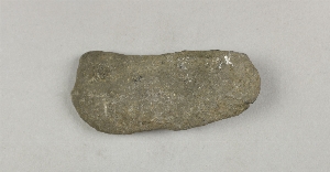
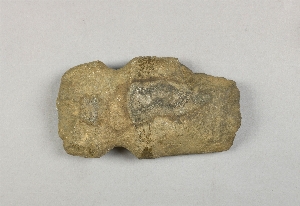
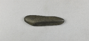
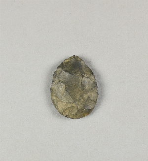
1 - 32 of 3,330 Records


