Search Collections
- Object[109]
- no[109]
- american[109]
- admiralty island[3]
- alaska[51]
- aleutian islands[7]
- anvik[1]
- anvik point[1]
- anvik river[1]
- attu island[7]
- big horn basin[2]
- bonasila[1]
- bucks county[20]
- canadian river[6]
- cape henlopen[4]
- chickies[2]
- china poot bay[1]
- choptank river[2]
- cook inlet[21]
- cottonwood creek (alaska)[4]
- cottonwood creek (texas)[1]
- daxatkanada[1]
- daxatkanada fort[2]
- delaware[4]
- east tennessee[1]
- gaddis run[6]
- grass island[1]
- haldeman's island[5]
- halibut cove[4]
- ishmailoff island[4]
- juniata county[1]
- kachemak bay[22]
- kansas[1]
- kashim[1]
- kateel[1]
- kenai peninsula borough[2]
- kootznahoo inlet[3]
- koyukuk river[1]
- lancaster county (pennsylvania)[9]
- landergin[4]
- little mike point[7]
- long level[1]
- lower yukon river valley[2]
- macdonald spit[1]
- maryland[2]
- mercer county[1]
- mesa verde[1]
- middle yukon valley[1]
- mifflin[1]
- mole harbor[3]
- near abilene[1]
- near englewood[1]
- new jersey[2]
- north america[5]
- northfork shoshone river[2]
- nugent ranch[1]
- palu:tat[2]
- park county (wyoming)[2]
- pennsylvania[32]
- putnam pit[3]
- reynold's ranch[3]
- sixty-foot rock[2]
- southeast coast (alaska)[7]
- southwest colorado[1]
- spruce tree house[1]
- susquehanna river valley[1]
- sussex county (delaware)[4]
- tennessee[1]
- texas[13]
- trenton[1]
- united states of america[109]
- waterbury's place[1]
- witmer's farm[2]
- wyoming[2]
- york[1]
- york county (pennsylvania)[2]
- yukon island[20]
- aleut[7]
- cliff dweller[1]
- eskimo[12]
- indian[1]
- kachemak bay culture iii[2]
- modern indian[1]
- prehistoric eskimo[6]
- taku tlingit[3]
- 1 f 7', ii[1]
- 2 d, 5' 8" - 6' 2", vii[1]
- 2 e 8' 9", ii[1]
- 2 m 6', v[1]
- 20 miles from cody[2]
- 4 k, 3'3" - 3'9"[1]
- 5 j, 1'6"[1]
- 64" level[1]
- b, 2' - 2'6", ix[2]
- b, surface, 9", ix[1]
- b1e 0-6"[1]
- base of macdonald spit, bay side.[1]
- beach in front of nutbeam's place[2]
- c - surface[1]
- c, 1' - 1' 6", ix[1]
- c, 3' 9" - 4' 3", vii[1]
- d, 1' - 2', viii or ix[1]
- d, 3' - 3' 6", vii[1]
- d, 6' - 6'6", vi[1]
- d, surface to 6", viii or ix[1]
- dr. ray's site on clear fork of brazos river[3]
- e 3' 10" - 4' 4", vii[1]
- e, 1' 9", to 2', viii[1]
- e, 1'3" - 1'9", viii[1]
- e, 5'6" - 6', vi[1]
- e3e 0-6"[1]
- f, 6'6" - 7'3", vi?[1]
- f1e 18-24" dark compact midden below loose shells e 1/2 of square[1]
- from a shell-heap, near lewes[4]
- from brandywine (laubach) camp-site.[7]
- from surface of leibhart-peters farm.[1]
- from workshop[1]
- from workshop.[4]
- g, 9' 6" - 10', i[1]
- h, 11' - 12', i[1]
- hole ii[1]
- indian village site on waterbury's place[1]
- layer 8[1]
- layer 8?[1]
- mesa site[4]
- near cohen island[2]
- point west of entrance to halibut cove, old midden in front of more recent house[2]
- ruin along ancient ditch near englewood[1]
- section d, near surface[1]
- slope of terrace #2, at house #1[1]
- workshop in ancient quarry.[6]
- yellow layer[1]
- andesite[7]
- argillite[7]
- basalt[1]
- boulder (stone)[1]
- brown jasper[1]
- chalcedony[4]
- chert[1]
- claystone[1]
- dolorite[4]
- flint[19]
- greenstone[2]
- jasper[2]
- obsidian[2]
- quartz[7]
- quartzite[1]
- red jasper[7]
- rhyolite[1]
- sandstone[1]
- shale[3]
- slate[5]
- stone[29]
- talc[1]
- wood[4]
- yellow jasper[12]
1 - 32 of 109 Records
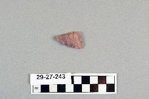
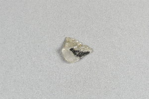
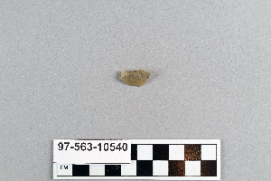
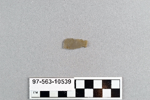
1 - 32 of 109 Records


