Search Collections
- Object[536]
- no[536]
- american[536]
- adams county (mississippi)[15]
- alaska[59]
- allegheny river[2]
- arkansas[3]
- bainbridge (pennsylvania)[10]
- bedford county (virginia)[2]
- berks county[9]
- big timber creek[6]
- boyertown[8]
- brownsville[3]
- bucks county[10]
- burlington county[9]
- california (state)[2]
- camden county[2]
- cape denbigh[3]
- cayuga lake[2]
- chattanooga[3]
- chickies[8]
- clark county (indiana)[6]
- clovis[3]
- conoy township[6]
- cumberland county (tennessee)[17]
- delaware valley[4]
- delaware water gap[7]
- east tennessee[18]
- elgin[8]
- ewing and bragdon site[3]
- fayette county (pennsylvania)[3]
- florida[16]
- fly site[4]
- forge island[6]
- frenchman's bay[3]
- georgia[5]
- gloucester county[6]
- gould ruin[4]
- grassy cove[15]
- gravel pit[3]
- hamilton[3]
- hamilton square[3]
- hancock county (maine)[3]
- handley ranch[4]
- illinois[4]
- indiana[30]
- iredell county[6]
- iyatayet[3]
- kentucky[4]
- klickitat county[4]
- knight island[13]
- lancaster county (pennsylvania)[32]
- lawrence county (indiana)[4]
- lexington (indiana)[3]
- lumberton[3]
- maine[3]
- marquette county[35]
- marshall county[5]
- marshall county (west virginia)[28]
- maryland[3]
- mercer county[23]
- michigan[3]
- mississippi[21]
- missouri[11]
- monongahela river[3]
- monroe county (pennsylvania)[7]
- natchez[3]
- natchez (mississippi)[9]
- near wheeling[8]
- new jersey[62]
- new mexico[4]
- new york[7]
- north carolina[9]
- northern alaska[7]
- norton sound[4]
- ohio[35]
- ohio county[5]
- ohio county (west virginia)[10]
- ohio river valley[5]
- old town[12]
- pennsylvania[94]
- point hope[12]
- rock retreat[8]
- southeastern utah[4]
- susquehanna valley[3]
- tallahassee[6]
- tampa bay[3]
- tennessee[24]
- texas[28]
- trenton[20]
- united states of america[536]
- upper fox river[3]
- virginia[3]
- washington (u. s. state)[4]
- washington boro[5]
- west virginia[35]
- wheeling[20]
- wheeling quadrangle[18]
- wisconsin[40]
- wolf creek[4]
- yakutat bay[14]
- york county (pennsylvania)[4]
- yukon island[17]
- 2 k 4' 6", iv or v; in hearthy shells[1]
- 2 mi. w. of gravel pit near clovis, n.m.[1]
- 3 h[1]
- 3' - 3'6"[1]
- 3' 9" - 4' 4"[1]
- 3' 9"- 4'3"[1]
- 4 h[2]
- 4 h (14' - 14' 6"), layer 1[1]
- 4 h, (12' 6" - 13'), layer 1[1]
- 4 j[1]
- 5 h[3]
- 5 j[2]
- 5 k,[1]
- 5' - 5'6"[1]
- 5'6" - 6'[3]
- 6' - 6'6"[1]
- 6'9" - 7'3"[1]
- 7' - 7'6"[1]
- 7' 5" - 7' 11"[1]
- 7'3" - 7'9"[1]
- anderson lake, about 15 mi. s.e. of clovis, n.m.[1]
- cave[2]
- from brandywine (laubach) camp-site.[4]
- from lake bank 1 mi. s.e. of gravel pit near clovis, n.m.[1]
- house 8[1]
- house floor - hearth[1]
- in susquehanna river[6]
- iyoa[1]
- iypc[1]
- k 1' 6"-2'[1]
- l, 5' 4" - 6' 3", layer 4[1]
- layer 5-c[1]
- layer 5a[1]
- layer 6 (5a?)[1]
- layer 6 (7?)[1]
- layer 6 or 7[2]
- layer 7[3]
- layer 7, sub-6, or 5-c[1]
- layer 7?[1]
- m, 5' 6" - 6' 6", layer 3[1]
- mad[1]
- midden - west point - 3' above bottom.[1]
- mound 1[2]
- mound 1 near chesser's house[1]
- mound b[9]
- mound b, upper 10' in layer of fire-cracked rocks[1]
- mound c[2]
- near washington[2]
- opposite locust grove haldeman estate[6]
- outside house[1]
- shores of delaware river at morrisville, pa., and trenton, n.j.[1]
- surface[2]
- surface around gravel pit near clovis, n.m.[1]
- surface in blown area[1]
- surface of field[1]
- test pit, depth: 6"[1]
- vicinity of millington[2]
- vicinity, surface[1]
- chipped[207]
- actual citation[35]
1 - 32 of 536 Records
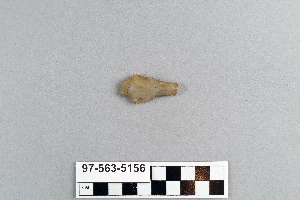
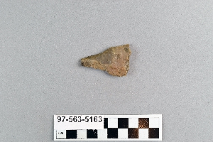
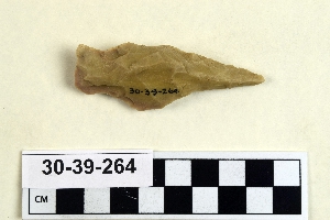
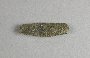
1 - 32 of 536 Records


