Search Collections
- Object[729]
- american[729]
- arrow[1]
- dart head[1]
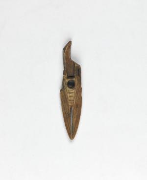
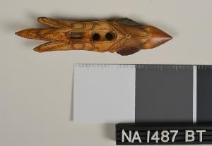
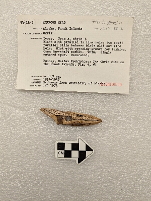
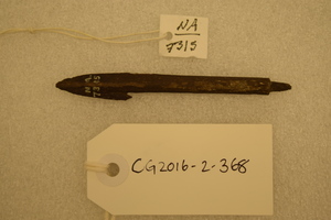
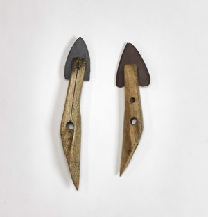
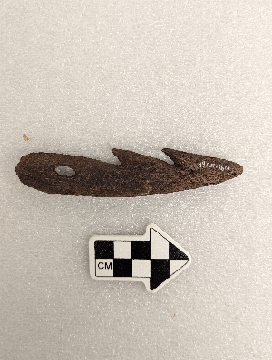
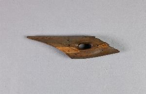
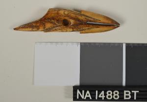
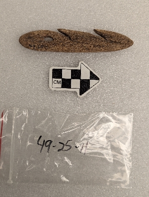
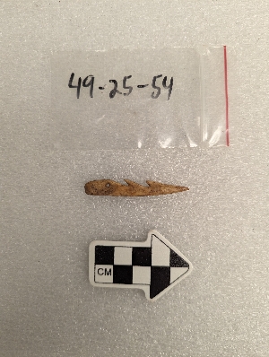
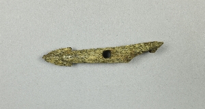
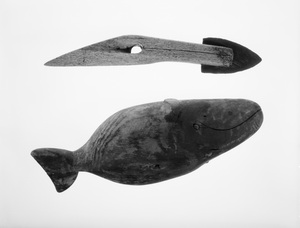
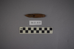
- harpoon head[729]
- harpoon head case[5]
- harpoon line[1]
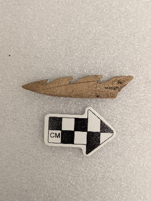
- lance head[25]
- line[3]
- toy[4]
- admiralty island[4]
- alaganik[1]
- alaska[729]
- bering strait[15]
- cape denbigh[4]
- cape nome[2]
- cape prince of wales[52]
- chaik bay[1]
- cook inlet[4]
- copper river delta[1]
- daxatkanada fort[14]
- fox farm[1]
- frank fox's place[1]
- greenland[1]
- hawkins island[4]
- holy cross[1]
- hood bay[2]
- indian island[1]
- iyatayet[4]
- kachemak bay[2]
- king island[1]
- knight island[11]
- kootznahoo inlet[14]
- kugusugaruk[22]
- kuskokwim river[4]
- little diomede island[1]
- lower yukon river valley[3]
- mole harbor[1]
- mouth of yukon river[1]
- new grayling[1]
- north america[40]
- north slope borough[38]
- northern alaska[27]
- northwest alaska[1]
- norton sound[4]
- nunavak[17]
- nunivak island[2]
- nuwuk[196]
- okiaby[1]
- old town[9]
- palugvik village[4]
- pegnuek[3]
- point barrow[63]
- point barrow region[248]
- point belcher[3]
- point hope[202]
- point spencer[3]
- prince william sound[4]
- punuk islands[11]
- rock shelter[1]
- st. lawrence island[15]
- united states of america[528]
- utkiavik[22]
- utkiavin[6]
- wainwright[5]
- walukpant[2]
- yakutat bay[11]
- yukon island[21]
- eskimo[581]
- eyak[1]
- inuit[20]
- ipiutak[1]
- kachemak bay culture iii[4]
- kachemak bay culture sub-iii[2]
- kootsnuhu tlingit[3]
- neo-eskimo[3]
- nukleet[4]
- okvik[11]
- prehistoric eskimo[72]
- taku tlingit[1]
- thule[17]
- tlingit[1]
- yakutat (culture)[2]
- 0'3'3" n of sw corner of square[1]
- 10'2" - 10'7"[1]
- 2 d, 1' 6" - 2', vii or viii[1]
- 2 d, 5' 3" - 5' 9", vii[1]
- 2 g, 2' 3" - 3'. viii (ix?)[1]
- 4 h, (12' 6" - 13'), layer i[1]
- 4 h, (13' 6" - 14'), layer 1[3]
- 4 j[2]
- 4 j, 1'3" - 1'10"[1]
- 4 k[1]
- 4 k, 13' 8" - 14' 2", layer 1[1]
- 4'2" e and 2' north of sw corner of square[1]
- 5 h, 11' 10" - 12' 4", layer 1[1]
- 5 j, 11' 6" - 12', layer 1[1]
- 5 k, 11' 6" - 12', layer 1[1]
- 5'3" - 5'9"[1]
- 8'5" - 9'[1]
- 9' 6" - 10'[1]
- b2e. 17" below surface.[1]
- b2e. 7" below surface[1]
- beach[1]
- beach below fort[1]
- bottom layer 21-27 inches[1]
- c1e 6-12"[1]
- c2e 6-12"[1]
- c3e below 18" - on edge of shelf - in midden mantle above burned layer[1]
- dark brown midden with thermal fractured rock[1]
- dark grey sand with charcoal fragments.[1]
- depth 6.5", gray sandy midden[1]
- e, 4' 4" - 4' 9", vii (vi ?)[1]
- e, 4' 4" - 4' 9", vii (vi ?) (just below loose shells)[1]
- f1w - loose shell fill in large post hole[1]
- f1w - under large rock. compact dark midden in pit below loose shells[1]
- f2e 0-6"[1]
- f3e 18-24"[1]
- fe3 0-6"[1]
- g1e 21" in shell midden - 60" e and 48" n[1]
- g2e 6-12"[1]
- h2e 12-18"[1]
- house 13, floor[1]
- house 203[1]
- house 8, fill, depth ca.49", on top of horizontal, collapsed wall of subsurface pit 24[1]
- iyed[2]
- iyem b-c[1]
- iyh 3 floor[1]
- kitchen midden[1]
- layer 5a[1]
- layer 5a?[1]
- layer 7[1]
- layer 8[1]
- layer 8 or 7?[1]
- midden - west point - 2' 6" above bottom.[1]
- mound 1[27]
- mound 2[3]
- mound 3[3]
- mound 3?[1]
- mound 5[4]
- mound 6[1]
- mound 8, under floor in subsurface, pit #24,[1]
- mound a, near house 5[1]
- mound a, upper level, depth 11"[1]
- mound a, upper level, depth:14 in[1]
- mound b near house 1[1]
- mound b, lower level, depth 31", brown sandy midden[1]
- mound b, lower level, depth 31", dark grey sand with charcoal fragments.[1]
- mound b, lower level, depth:26"[1]
- mound b, lower level, depth:38, pit #8,[1]
- mound d, upper level, depth 13", dark rocky midden[1]
- n. surface - 1' 6"[1]
- new midden[1]
- o-u 27 1/2 just above hard surface of pit a[1]
- rubbish heap, west point.[1]
- stratum i or ii, 2d, level 2[1]
- stratum i, 2e, level 3[1]
- whale[1]
- carved[6]
- engraved[1]
- perforated[2]
- actual citation[25]
1 - 32 of 729 Records


1 - 32 of 729 Records