Search Collections
- Object[129]
- american[129]
- alaska[129]
- aleutian islands[5]
- anderson bay[1]
- angiluk[1]
- atka[1]
- atka island[2]
- attu island[1]
- cape denbigh[5]
- cape nome[2]
- cape prince of wales[2]
- cape starichkof[1]
- chenega island[3]
- cook inlet[8]
- cottonwood creek (alaska)[1]
- diomede island[1]
- diyaguna'et[1]
- ellamar[1]
- esther passage[2]
- ewan bay[2]
- fish creek[1]
- fox farm[4]
- grassy island[1]
- hawkins island[2]
- hinchinbrook island[1]
- hologochaket[2]
- innoko river[2]
- iyatayet[5]
- kachemak bay[4]
- kayak island[1]
- kenai[2]
- kenai peninsula[1]
- kimiklik village[2]
- king island[1]
- knight island[14]
- knik arm[1]
- kotzebue sound[1]
- kugusugaruk[2]
- kuskokwim river[16]
- little diomede island[1]
- little mike point[1]
- lost river[1]
- lower yukon river valley[2]
- macdonald spit[1]
- montague island[3]
- mouth of kuskokwim river[1]
- mummy island[1]
- north america[5]
- north slope borough[2]
- norton sound[5]
- nunaktuk island[1]
- nuwuk[1]
- old town[13]
- paddy bay[2]
- palu:tat[2]
- palugvik village[2]
- point barrow[3]
- point barrow region[11]
- point hope[3]
- port graham[2]
- prince william sound[9]
- qeyagwik[1]
- shemya island[1]
- smith's fox farm[2]
- stockdale harbor[3]
- swanson creek[1]
- unalakleet[12]
- united states of america[67]
- utkiavik[8]
- wainwright[1]
- yakutat bay[15]
- yukon island[13]
- yukon river valley[1]
- aleut[4]
- eskimo[34]
- indian[4]
- inuit[2]
- kachemak bay culture iii[3]
- kachemak bay culture sub-iii[1]
- kachemak bay iii[1]
- paleo-eskimo[3]
- prehistoric[1]
- prehistoric eskimo[15]
- tanaina[1]
- tulare[1]
- yakutat (culture)[6]
- 14" deep in midden.[1]
- 1st site on right lagoon[1]
- 1st site on right side of lagoon[1]
- 2'9" - 3'3"[1]
- 2nd site on right lagoon[1]
- 3' 9" - 4' 5"[1]
- 4' 6"[1]
- 4'6"[1]
- 4'9" - 5'6"[1]
- 5 h[1]
- 5 h, 10' 3" - 10' 9". at the side of a hole dug into layer 1 from layer 1 from layer 5-a.[1]
- 5' 4" - 5' 9"[1]
- 9 ' below surface[1]
- beach on northeast point[1]
- beach, base of macdonald spit on the bay side[1]
- c + d, 3' - 3'3"[1]
- c, 2'-2'6", ix[1]
- d, 4' 9" - 5', vii[1]
- depth of 1 foot[1]
- e 4' 4" - 6', vii (in loose shells)[1]
- found in an abandoned house.[1]
- found on cannery site, probably from old village of sustin[1]
- found on each[1]
- gun.[3]
- h, 12' - i[1]
- house #7[2]
- house 1 - fill[1]
- house 119[4]
- house 120[3]
- house 2[2]
- house 3[1]
- house 8[1]
- house 9 fill[1]
- house pit #1 - depth 21"[1]
- house pit 1 - fill[1]
- house pit 1 fill, light brown ashy sand[1]
- ip house[1]
- iyh7-w[1]
- iym[1]
- j[1]
- k 1' 6"-2'[1]
- layer 4, 5, or 5a?[1]
- layer 7?[1]
- layer 9[1]
- midden.[1]
- mound 1[1]
- mound 5[1]
- mound a, near house 5[1]
- mound b - depth 21"[1]
- mound b - upper level, depth 10"[1]
- mound b, light brown ashy sand[1]
- mouth of river[1]
- n 2.5, w 2 - wall continuation[2]
- s 4.5, w 1.5 - floor[1]
- stratum i or iii?, upper half[1]
- stratum iii, 2f, level 6[1]
- basalt[1]
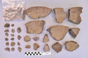
- ceramic[10]
- clay[17]
- dolorite[4]
- earthenware[1]
- felsite[1]
- greenstone[1]
- lava stone[1]
- limestone[4]
- plant fiber[1]
- sandstone[14]
- soapstone[11]
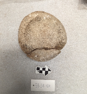
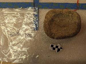
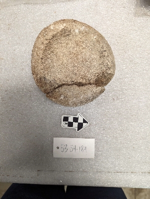
- stone[59]
- syenite[1]
- tin[1]
- tuff[1]
- wood[1]
- ground[2]
- ground stone[9]

1 - 32 of 129 Records