Search Collections
- Object[265]
- american[265]
- grinding stone[4]
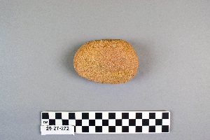
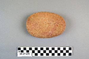
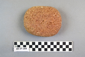
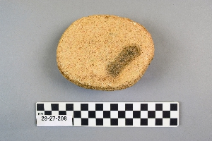
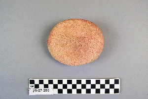
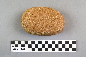
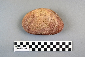
- mano[265]
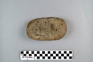
- metate[3]
- pebble[1]
- polishing stone[1]
- sandstone[1]
- "su" site near reserve[2]
- aguan valley[1]
- alibates creek[3]
- arizona[30]
- belize[16]
- california (state)[19]
- canadian river[6]
- caracol (central america)[16]
- caye district[16]
- ccc camp[2]
- cempoala[1]
- chama (guatemala)[1]
- chipal[1]
- cochiti pueblo[1]
- colorado[2]
- contrayerba[1]
- culberson county[1]
- culhuacan[1]
- deal[1]
- department of alta verapaz[1]
- department of suchitepequez[2]
- department of verapaz[1]
- descanso[1]
- distrito federal[1]
- duncan (arizona)[3]
- durango[9]
- el zape[2]
- escondido[4]
- fanny jones ranch[1]
- grapevine creek[1]
- greater southwest[1]
- guadalupe mountains[1]
- guatemala[6]
- hervideros[3]
- honduras[1]
- hulburd grove[1]
- illinois[1]
- jamacha valley[2]
- kroenig ranch[6]
- landergin[5]
- las limones[2]
- logan (new mexico)[76]
- logan (texas)[24]
- loiza[1]
- maricopa county[2]
- mason valley[1]
- mexico (central america)[13]
- montezuma county[1]
- mora river[1]
- navajo mountain[1]
- navajo reservation[1]
- near abilene[7]
- near camp verde[1]
- near dalhart[1]
- new mexico[89]
- nugent ranch[2]
- oraibi[1]
- pampur[1]
- panama[17]
- patulul[2]
- phoenix (arizona)[2]
- pike county (illinois)[1]
- pueblo mound[6]
- puerto rico[1]
- quay county[77]
- quelites[1]
- red house[1]
- salt river valley[1]
- san diego county[15]
- san diego plateau[4]
- santa ana (zape)[2]
- santa barbara county[2]
- saugus[2]
- sitio conte[14]
- southeastern utah[4]
- southwest arizona[2]
- southwest united states[19]
- southwestern colorado[4]
- st. lucia cozumahualpa[1]
- teotihuacan (mexico)[1]
- texas[43]
- third mesa[1]
- torrey pines[4]
- united states of america[135]
- upper rio grande river[1]
- utah[3]
- valley of mexico[1]
- vegas valley[4]
- veracruz (mexico)[1]
- villa antonio amaro[2]
- warm springs[2]
- watrous[7]
- west indies[1]
- western united states[1]
- whitewater draw[12]
- wilcox[2]
- williams cave[1]
- yuma[2]
- sitio conte[14]
- ancestral pueblo[9]
- chalchihuites[9]
- chiriqui[3]
- chocotegan[1]
- cliff dweller[3]
- cliff-dweller[1]
- cochise[13]
- cochiti pueblo[1]
- cocle[14]
- hohokam[2]
- hopi[1]
- keresan[1]
- maya[3]
- mogollon[2]
- papage[2]
- pecos cave dweller[1]
- pueblo[2]
- taino[1]
- totonac[1]
- 9 mi se of wilcox, branch of pluvial lake cochise[2]
- aguan valley[1]
- centre line[2]
- depth of 18 in.[1]
- depth of 27 in.[1]
- flattened ovoid, nearly vertical edge.[1]
- found in water course near the pyramid of teotihuacon.[1]
- from cliffhouse near red house[1]
- from ruins within 10 miles of phoenix.[2]
- loma pelona (zape), surface find[1]
- loma pelona, surface find[1]
- mesa site[5]
- near upper rio grande river[1]
- near white river[1]
- pasture, mound 2, w. side[1]
- popolateca[1]
- river[1]
- sand site[2]
- surface[9]
- surface find[4]
- surface find.[3]
- surface in blown area[1]
- surface of plowed field[2]
- surface site in cotton field mile e. of lawn[1]
- surface site near abilene[2]
- trench 2[5]
- trench 2, burial 13[2]
- trench 2, burial 19[3]
- two flattened faces[1]
- vicinity altar 7[3]
- zape region; ranch between quelites & contrayerba, surface or mound 23[1]
- andesite[1]
- basalt[2]
- breccia[1]
- ceramic[3]
- conglomerate[1]
- diorite[2]
- felsite[2]
- granite[12]
- lava stone[4]
- limestone[1]
- mano[1]
- metate[1]
- obsidian[1]
- porphyritic stone[1]
- porphyry[2]
- quartzite[1]
- rhyolite[1]
- sandstone[9]
- stone[222]
- volcanic rock[6]
- volcanic stone[1]
- chipped[2]
- ground[35]
- groundstone[27]
1 - 32 of 265 Records
1 - 32 of 265 Records