Search Collections
- Object[219]
- no[219]
- arrow point[1]
- bannerstone[1]
- bird stone[1]
- cast[5]
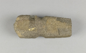
- chisel[1]
- lithic[1]
- mollusk shell[1]
- object[219]
- pin[1]
- polisher[2]
- slab[2]
- stopper[1]
- tube[1]
- alabama[1]
- alaganik[1]
- alaska[146]
- bainbridge (pennsylvania)[3]
- burlington county[2]
- camden county[5]
- cape denbigh[11]
- chickies[13]
- cook inlet[8]
- copper river[1]
- cottonwood creek (alaska)[1]
- cumberland ridge[1]
- daxatkanada fort[4]
- east tennessee[1]
- fish creek[1]
- fish creek indian reserve[1]
- floyd county (georgia)[1]
- foster's bend[1]
- fox farm[2]
- georgia[1]
- greenup county[1]
- halibut cove[2]
- hampton falls[1]
- hawkins cut-off[2]
- hawkins island[4]
- illinois[1]
- indian mills[1]
- indiana[18]
- ishmailoff island[2]
- iyatayet[11]
- kachemak bay[6]
- kaighn's point[1]
- kentucky[1]
- knakatnuk village[1]
- knight island[11]
- kootznahoo inlet[4]
- kustatan/west foreland[1]
- lancaster county (pennsylvania)[17]
- lewisburg region[1]
- little timber creek[1]
- louisiana[1]
- lumberton[2]
- mississippi[1]
- mississippi valley[1]
- missouri[1]
- montgomery county (pennsylvania)[1]
- natchez (mississippi)[1]
- new hampshire[1]
- new jersey[10]
- new york[1]
- newton creek[2]
- northern alaska[4]
- northumberland county[1]
- norton sound[11]
- nunakchuk[2]
- ohio[7]
- old town[11]
- palugvik village[4]
- pennsylvania[24]
- plymouth meeting[1]
- point barrow region[46]
- point hope[28]
- prince william sound[6]
- punuk islands[1]
- red canyon[1]
- rock retreat[7]
- shamong township[1]
- southeastern utah[3]
- susquehanna river[1]
- tennessee[1]
- tutka[1]
- union county (pennsylvania)[1]
- united states of america[219]
- utkiavik[46]
- vanderburgh county[17]
- warren county (ohio)[1]
- witmer's farm[1]
- yakutat bay[11]
- york[3]
- york county (pennsylvania)[3]
- yukon island[24]
- old town[1]
- old town ii[9]
- old town iii[1]
- prehistoric[1]
- athapaskan[2]
- basketmaker[1]
- cliff dweller[2]
- denbigh flint complex[4]
- eskimo[108]
- ipiutak[1]
- kachemak bay culture iii[5]
- knatana[1]
- norton[4]
- nukleet[2]
- okvik[1]
- prehistoric eskimo[7]
- tlingit[1]
- 2 1/2 ' below surface.[1]
- 2 d, 3' 6" - 4', vii[1]
- 2 e, 1' - 1' 6", viii (ix)[1]
- 2 e, 4' - 4' 8", vii[1]
- 2 g, 4' - 4' 8", vi or vii[2]
- 2 g, 5' 10" - 6' 5" vi or vii[1]
- 2'6" - 3' (?)[1]
- 2f, surface - 1'9", x[1]
- 3 k[1]
- 3 m 3', viii[1]
- 4 h[2]
- 4' to 3 1/2' above bottom midden - west point .[1]
- 5 j[1]
- 5'6" - 6'[1]
- 6' - 8'[1]
- 9'6"[1]
- a2e 6"-12"[1]
- about 1 1/2 ' below surface of midden.[2]
- b3e 3'' below surface[1]
- c3e 0-6" in w. edge[1]
- d, 6' 6" - 7' 3", iii[1]
- d, 6' 6" - 7', iii[1]
- d, surface to 6", viii or ix[1]
- e, 2' 9" - 3' 3", vii[1]
- f, 6' 6" - 7' 3", iii[2]
- f, 6' 6" - 7' 4", iii[1]
- f1e 6-12"[1]
- g, 11' - 11' 6", i[1]
- hole ii[1]
- house 9[1]
- house ruin above second bench above cannery.[1]
- in very shallow midden.[1]
- iy[1]
- iye[1]
- iyed[1]
- iyh1-hf4 dfc[1]
- iyh3[1]
- iyh4 floor[1]
- iyhi-d[1]
- iym[1]
- iype-1[1]
- iype-3[1]
- iyph(?)[1]
- j. 1'- 1' 6"[1]
- layer 5a[1]
- layer 6 or 7[1]
- layer 7?[1]
- layer 9[1]
- layer 9 to 7?[1]
- midden, west point botomm[1]
- midden, west point, bottom.[1]
- mound b, depth 22"[1]
- mound b, lower level[1]
- point west of entrance to halibut cove[2]
- storage house fill. subsurface pit #15, depth 32"[1]
- stratum i, 1b, 0-6"[1]
- subsurface pit #15[5]
- subsurface pit #15, depth 32"[1]
- subsurface pit #15, depth 33"[1]
- surface - 2' 6"[1]
- upper half[1]
- animal bone[1]
- antler[12]
- argellite[1]
- banded slate[1]
- bark[2]
- basalt[1]
- bone[90]
- brass[1]
- chert[4]
- clay[15]
- concretion[2]
- copper[1]
- fish bone[1]
- flint[1]
- fossil ivory[2]
- iron[1]
- ivory[9]
- leather[2]
- marble (stone)[3]
- metal[2]
- mica schist[1]
- obsidian[1]
- plaster[5]
- quartz[1]
- quartzite[1]
- rhyolite[1]
- sandstone[2]
- shale[2]
- slate[5]
- soapstone[1]
- steatite[1]
- stone[36]
- walrus ivory[2]
- whale bone[1]
- wood[13]
1 - 32 of 219 Records
1 - 32 of 219 Records