Search Collections
- Object[74]
- no[74]
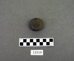
- disk[1]
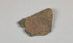
- paint stone[74]
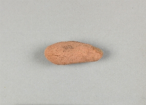
- pebble[2]
- adams county (mississippi)[3]
- alaska[33]
- australia[1]
- bingaman plantation[1]
- brazil[1]
- brazilian amazonas[1]
- brownsville[1]
- bucks county[2]
- burlington county[1]
- california (state)[1]
- camden (south carolina)[1]
- cape denbigh[1]
- carbondale[1]
- colorado[1]
- colorado river region[1]
- concordia parish[1]
- connor plantation[1]
- cook inlet[1]
- cottonwood creek (alaska)[1]
- cumaruara[1]
- daxatkanada fort[18]
- descanso[1]
- dordogne[1]
- durham (us)[1]
- eastern united states[1]
- fayette county (pennsylvania)[1]
- ferguson plantation[1]
- ferriday plantation[1]
- flint quarry[1]
- france[1]
- georgia[1]
- gillespie plantation[1]
- gloucester county[1]
- guajira peninsula[1]
- illinois[3]
- indian territory[1]
- iyatayet[1]
- jackson county (illinois)[1]
- jackson county (mississippi)[2]
- jefferson county (mississippi)[2]
- kachemak bay[1]
- knight island[10]
- kootznahoo inlet[18]
- lago grande[1]
- larimer county[1]
- lindenmeier site[1]
- lost river[1]
- louisiana[2]
- lower yukon river valley[1]
- mississippi[6]
- monongahela river[1]
- moorestown[1]
- natchez (mississippi)[1]
- near abilene[1]
- near ft. collins[1]
- nessudat[1]
- new grayling[1]
- new jersey[2]
- north america[1]
- norton sound[1]
- ohio[1]
- old town[10]
- pennsylvania[3]
- pine ridge[1]
- point barrow[1]
- prospect[1]
- richmond (australia)[1]
- san diego county[1]
- scraper maker site[1]
- south carolina[1]
- southeastern australia[1]
- southeastern utah[2]
- southwest colorado[1]
- tabaterie[1]
- tennessee[1]
- tensas parish[1]
- texas[1]
- uleri[1]
- united states of america[55]
- venezuela[1]
- victoria (australia)[1]
- williams plantation[1]
- yakutat bay[11]
- mousterian[1]
- old town iii[10]
- basket-maker[1]
- cliff dweller[1]
- denbigh flint complex[1]
- eskimo[1]
- folsom[1]
- mousterian[1]
- "bottom level"[1]
- 2s lying on surface of yellow clay, below midden[1]
- 6' 3" below surface[1]
- a2e 6-12"[1]
- b1e 0-6"[1]
- c2e 12-18"[2]
- c2e 6-12"[1]
- d1w 0-6"[1]
- e1w 6-12'[1]
- e2e 12-18"[1]
- e2e 18-24"[1]
- e2e 6-12"[1]
- f1e 18-24" dark compact midden below loose shells e 1/2 of square[1]
- f1w 10-12" midden[1]
- f2e 18-24"[1]
- f3e 12-18"[1]
- field find[1]
- from around spring on top of hill near durham jasper quarry[1]
- from brandywine (laubach) camp-site.[1]
- g1w 6-12"[1]
- g2e 0-6"[1]
- house 1, fill, depth 17", tan sandy midden[1]
- house 1, fill, depth 4", dark sandy midden[1]
- house 1, fill, depth 5", black sandy midden[1]
- house 1, fill, depth 6", tan sandy midden[1]
- house 1, fill, depth 10", tan sandy midden[1]
- house 13, floor[1]
- house 8, fill, depth 37", dark gray sandy midden[1]
- house 8, floor, depth 45", light tan sandy midden[1]
- mound[1]
- mound a, lower level, depth 18", dark gray sandy midden[1]
- mound b, fill, depth 4", black rocky midden[1]
- mound b, fill, depth 8", black tan sandy midden[1]
- o-u 18-24" black midden[1]
- surface; 1.5 km ne of lagoon de la puja.[1]
- test pit 2, depth 6"[1]
- burned[1]
- painted[2]
- perforated[1]
- polished[2]
1 - 32 of 74 Records


1 - 32 of 74 Records