Search Collections
- Object[651]
- no[651]
- african[3]
- american[190]
- asian[10]
- egyptian[156]
- european[5]
- mediterranean[49]
- near eastern[214]
- oceanian[24]
- africa[1]
- alaska[3]
- aleutian islands[1]
- ancon[1]
- anderson lake[2]
- anyang[1]
- arizona[2]
- asia[1]
- attu island[1]
- australia[2]
- ayios ermoyenis[1]
- balabish[3]
- ballas[16]
- bamboula[1]
- baq'ah valley[10]
- bartlett shellheep[9]
- belize[1]
- belt cave[2]
- beneath the temple[1]
- benque viejo[1]
- beth shean[138]
- beth shemesh[48]
- blue spring[6]
- bolivia[1]
- brazil[3]
- brevard county[5]
- british new guinea[1]
- buhen[1]
- burlington county[9]
- canyon[1]
- chickies[1]
- collier county[7]
- colombia[13]
- colorado river region[3]
- corrego grande[3]
- crete[46]
- cyprus[3]
- dendereh[48]
- dhiban[5]
- dordogne[2]
- dra abu el-naga[8]
- east st. louis[2]
- egypt[155]
- florida[62]
- france[4]
- gravefield i, oldest part[10]
- greece[46]
- illinois[2]
- indian river[19]
- iran[4]
- iraq[3]
- israel[186]
- jordan[18]
- kaiara kot[4]
- key marco[2]
- knossos[45]
- kourion[3]
- la madeleine[2]
- lake harney[4]
- lake ruth[5]
- marco pass[5]
- matto grosso[3]
- merimdeh[6]
- merrits island[19]
- mexico (central america)[6]
- meydum[2]
- mit-rahineh[59]
- naqada[16]
- near abilene[4]
- near phoenix[2]
- new britain[6]
- new guinea[5]
- new jersey[9]
- new mexico[2]
- nippur[3]
- northwest of the town[5]
- pachacamac[21]
- panama[2]
- peru[25]
- philippine islands[9]
- sao lorenco river[3]
- site 8[2]
- sitio conte[2]
- southeastern utah[12]
- southwest coast (florida)[18]
- southwest colorado[5]
- southwestern colorado[2]
- st. clair county[2]
- sun temple[2]
- tall as-sa'idiyya[3]
- tasmania[2]
- tepe hissar[2]
- texas[8]
- tick island[4]
- united states of america[93]
- venezuela[33]
- volusia county[15]
- west nakanai[6]
- west pakistan[5]
- zaire[2]
- kourion[3]
- sitio conte[2]
- bohemian neolithic[1]
- byzantine[27]
- chalcolithic[1]
- early arabic[7]
- early bronze i[1]
- early iron age[1]
- egyptian predynastic period[12]
- hellenistic[17]
- hellenistic period[4]
- hissar ii[1]
- hissar iii[1]
- iron age ia[5]
- iron age ib[9]
- iron age iia[7]
- iron age iib[20]
- late bronze age[3]
- late bronze ib[35]
- late bronze iia[35]
- late bronze iib[5]
- late cypriot iiib[1]
- late minoan i[1]
- magdalenian[2]
- middle kingdom[1]
- new kingdom[1]
- prehistoric[2]
- roman[17]
- roman period[13]
- sa'idiyya vi[1]
- shang dynasty[1]
- twelfth dynasty[2]
- twenty-second dynasty[1]
- undetermined[1]
- basket-maker[5]
- bohemian neolithic[1]
- calusa[16]
- chinese[1]
- cliff dweller[5]
- cocle[2]
- coptic[1]
- cypriot[1]
- eastern bororo[3]
- eskimo[1]
- hellenistic[4]
- indian[1]
- iron age[2]
- lakota[1]
- magdalenian[2]
- maya[1]
- minoan[1]
- natufian[1]
- post-contact[1]
- pueblo[2]
- roman[13]
- tairona[2]
- 1.5 km. west of port estrella, sand dune near cacimba (reservoir); surface[1]
- 10/13 e-w balk[1]
- 100.4[1]
- 13:064 b[1]
- 13:065[1]
- 13:093[1]
- 13:163 a[1]
- 13:174 a[2]
- 13:182[1]
- 13:184 a[1]
- 13:194[1]
- 13:281 b[1]
- 13:291 a[1]
- 13:376 a[1]
- 15:515 a[1]
- 15:712 b[1]
- 2 kms. east of port estrella; surface[1]
- 2 l 6' 3", ii[1]
- 200[1]
- 200.1[2]
- 200.12 mid debris[1]
- 200.14 lowest debris west of 18 n[1]
- 200.16 middle[1]
- 200.19 stratum 4 metres above merenptah[1]
- 200.20 mid[1]
- 200.4 debris above door[1]
- 200.5 middle debris w of rm 9[1]
- 23:290.1[1]
- 23:384 c[1]
- 23:674 e[1]
- 23:681 f[1]
- 23:683 f[1]
- 23:834[1]
- 25:317 d[1]
- 3 km. north of castillettes in sand dune. surface, site a[1]
- 32:282 b[1]
- 330 west upperr debris[1]
- 340 west low[1]
- 380 west end[1]
- 40" level[1]
- 46[1]
- 5' from urn burial 35-32-49, surface[1]
- 5:531 c[3]
- 5:541 a[1]
- 5:820.1[1]
- 5:891 b[1]
- 7:713 c[2]
- 7:733 b[1]
- 7:733 c[1]
- 7:757[1]
- 7:840.5[1]
- 7:950.1[1]
- 8:622 a[2]
- 8:631 b[4]
- ancient grave.[1]
- bottom of deposit in cut bank below house pit[1]
- burial cave a4[1]
- c fort[1]
- castilletes[1]
- castillettes[1]
- castillettes, shell heap #2[1]
- central area rm 74[1]
- central area, from south of great door, abotu 1 metre below inner height of door.[1]
- central area, rm 105[1]
- central fort[1]
- dr. ray's site on clear fork of brazos river.[1]
- fort[2]
- found in silt section[1]
- found on the surface[1]
- found with a mummy[1]
- fourth grotto[1]
- from 3-foot level[4]
- from 3rd stratum[1]
- from a mummy[5]
- from a mummy.[1]
- from ancient grave.[1]
- from lowest stratum (mound floor)[1]
- from the loosened soil.[2]
- from the mummy of a girl[1]
- from upper stratum[3]
- grave 5, at child's forehead[1]
- h60[1]
- hole 3[1]
- house 4/3[3]
- in cut 12 - 18" from top of bank[1]
- level 7[2]
- level b[1]
- locus 1[1]
- locus 2[1]
- locus 3[4]
- lower mid rm552[1]
- mid stratum 548 on floor of rm 9[1]
- mid stratum 548, floor of rm 9, east of fort[1]
- mid stratum 548, floor or rm9, east of fort[1]
- mound[5]
- paint creek[4]
- palace[9]
- palace, shrine of the snake goddess[36]
- tomb b212[2]
- upper mid 591[3]
- abalone shell[1]
- animal[1]
- bean[1]
- bivalve[1]
- bivalve shell[2]
- bone[2]
- busycon shell[1]
- ceramic[1]
- chalcedony[2]
- charcoal[1]
- cockle shell[1]
- conch shell[2]
- conchicura shell[1]
- cowrie[2]
- cowrie shell[3]
- fiber[1]
- fish bone[1]
- gastropod shell[1]
- hair[1]
- ivory[1]
- jadeite[1]
- limestone[1]
- limpet[1]
- marine shell[3]
- mollusk shell[11]
- murex shell[1]
- mussel[1]
- mussel shell[1]
- pigment[1]
- plaster[45]
- seed[1]
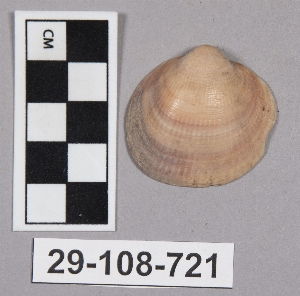
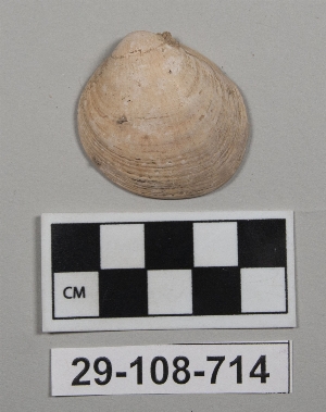
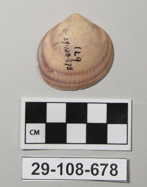
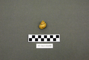
- shell[542]
- snail[1]
- stone[4]
- tooth[1]
- tortoise shell[2]
- turtle shell[1]
- e. gillieron[45]
1 - 32 of 651 Records
1 - 32 of 651 Records