Search Collections
- Object[370]
- no[370]
- american[370]
- arrowhead[1]
- cast[3]
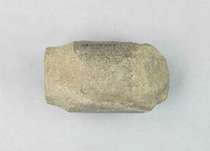
- chisel[1]
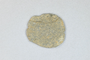
- flake[5]
- net sinker[1]
- projectile point[1]
- tool[370]
- addison's key[7]
- alaska[22]
- aleutian islands[7]
- alibates creek[2]
- attu island[3]
- bainbridge (pennsylvania)[1]
- berks county[25]
- bivens estate ranch[2]
- boyertown[25]
- brazos river[2]
- burke county[1]
- cape denbigh[1]
- chatham county[1]
- chattanooga[4]
- chickies[4]
- chokoloskee[21]
- chokoloskee key[26]
- citrus county[2]
- clear fork[2]
- cliff house[8]
- clinton county[23]
- collier county[12]
- colorado[3]
- cora key[2]
- crystal river[2]
- cumberland county (tennessee)[1]
- daxatkanada fort[10]
- delaware[1]
- delaware county (pennsylvania)[2]
- east tennessee[2]
- ewing and bragdon site[3]
- fikahatchee key[41]
- florida[226]
- frenchman's bay[3]
- georgia[2]
- gilbert's key[2]
- goodland point[14]
- green lake county[1]
- hancock county (maine)[3]
- hawley[2]
- illinois[1]
- irene mound site[1]
- iyatayet[1]
- jones county (texas)[2]
- josselyn key[2]
- kentucky[1]
- key marco[11]
- kootznahoo inlet[10]
- lancaster county (pennsylvania)[17]
- lee county (florida)[108]
- little marco[1]
- little mike point region[3]
- lock haven[23]
- locust grove[1]
- long island (ny)[1]
- maine[3]
- mancos[3]
- marco island[6]
- markham[2]
- marshall county (west virginia)[1]
- mcilvaine's key[7]
- minden[1]
- monroe county (florida)[14]
- montague island[1]
- montgomery county (new york)[1]
- nameless key[3]
- near wheeling[1]
- new mexico[1]
- new york[2]
- norton sound[1]
- ohio[2]
- ohio county (west virginia)[1]
- pennsylvania[68]
- point barrow[3]
- pulaski county[1]
- putnam county (florida)[1]
- rock retreat[3]
- rosebud[2]
- saltville[3]
- san juan drainage[13]
- san juan drainage area[2]
- sevier county[1]
- shell bluff[1]
- shemya island[4]
- smyth county (virginia)[3]
- south dakota[2]
- southeastern utah[19]
- southwest colorado[4]
- stockdale harbor[1]
- tallahassee[8]
- tampa bay[2]
- tennessee[5]
- texas[4]
- uintah mountains[1]
- united states of america[370]
- utah[1]
- virginia[5]
- wason[2]
- watrous[1]
- witmer's farm[8]
- aleut[7]
- algonquin[12]
- ancestral pueblo[3]
- calusa[3]
- cliff dweller[11]
- eskimo[3]
- iroquois[10]
- norton[1]
- prehistoric eskimo[1]
- seminole[2]
- thule[3]
- ute[1]
- 1-s 6-12'' below moss.[1]
- 1st site on right lagoon[1]
- 2'9" e and 4'3" n of sw corner of square[1]
- 2-s 6-12"[1]
- b2e depth 8"[1]
- b3e 4" below surface.[1]
- c2e 12" - 18"[1]
- cave[1]
- d2e 6-12"[2]
- d2e depth 6"[1]
- farm about 3 mi. above lock haven on south bank of west brnach of susquehanne river, surface.[2]
- fiw 6-12"[1]
- from bank along clear fork of brazos river about 2.5 mi. east of hawley, texas, found 20 ft. below surface, just below level of a large mammoth tusk.[2]
- from cliff house or cave.[1]
- h2e 0'6"[1]
- hays stewart farm, operation ii, surface[1]
- iyem upper[1]
- midden ("kitchen trash deposit")[3]
- monro farm, operation i, pit #26, depth 7-8 in[1]
- monro farm, operation i, pit #26, depth 7-9 in[1]
- monro farm, operation i, test pit #1, depth 17 in[4]
- monro farm, operation i, test pit #2, depth 20 in[1]
- mound ii[3]
- near crystal river[1]
- operation iii[1]
- operation iii, pit # e and f, -3[3]
- operation iii, pit no. e and f, -3[1]
- pine station[5]
- pine station, quiggle farm, operation iii, pit no. g and h, -1 and -2. depth not recorded.[2]
- pine station, quiggle farm, operation iii, surface.[2]
- quiggle farm[5]
- total depth 9-15"[1]
- vicinity, surface[3]
- antler[4]
- argillite[2]
- beaver tooth[1]
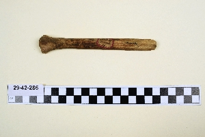
- bone[23]
- busycon shell[3]
- chalcedony[2]
- chert[11]
- conch shell[2]
- conglomerate[1]
- copper[1]
- deer antler[1]
- deer bone[4]
- deer horn[1]
- flint[13]
- jasper[1]
- leather[1]
- mollusk shell[205]
- phyllite[1]
- plaster[3]
- quartz[1]
- quartzite[10]
- sandstone[2]
- schist[7]
- shale[3]
- shell[2]
- slate[2]
- steel[1]
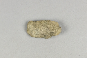
- stone[60]
- whale bone[2]
- wood[7]
- chipped[54]
- unfinished[9]
1 - 32 of 370 Records
1 - 32 of 370 Records