Search Collections
- Object[1,364]
- no[1,364]
- american[1,364]
- adams county (pennsylvania)[5]
- alaska[651]
- albany county[4]
- alibates creek[5]
- anclota estuary[26]
- arizona[3]
- bainbridge (pennsylvania)[4]
- bartlett shellheep[14]
- bedford county (virginia)[4]
- big horn basin[25]
- bivens estate ranch[4]
- bridger basin[5]
- bucks county[18]
- burlington county[18]
- canadian river[9]
- cape darby[8]
- cape denbigh[38]
- cape nome[489]
- charlton county[4]
- chattanooga[6]
- chesser's island[4]
- chickies[76]
- colorado[6]
- cook inlet[19]
- cottonwood creek (alaska)[4]
- crescent river[4]
- cumberland county (tennessee)[4]
- daxatkanada fort[7]
- delaware river[3]
- delaware valley[5]
- east orland[3]
- east tennessee[8]
- eastern workshop[39]
- fairfield[5]
- flint ridge[9]
- florida[60]
- fox farm[8]
- georgia[6]
- gloucester county[11]
- gould ruin[11]
- grassy cove[5]
- gungnuk site[3]
- hammonton[4]
- handley ranch[11]
- indiana[8]
- inskip region[4]
- iyatayet[38]
- jack mountain[5]
- kachemak bay[7]
- kings ruins[5]
- klickitat county[5]
- kootznahoo inlet[7]
- kraale[26]
- lancaster county (pennsylvania)[133]
- lehigh county[84]
- locust grove[4]
- lodge pole trail[5]
- loudonville[4]
- macungie[77]
- madjujuinuk site[5]
- maine[59]
- marquette county[13]
- mercer county[42]
- middle workshop[14]
- morgantown road[20]
- mt. kineo[56]
- near dalhart[5]
- new jersey[127]
- new york[5]
- north america[7]
- north slope borough[4]
- northampton county[4]
- northfork shoshone river[25]
- norton sound[46]
- ohio[19]
- park county (wyoming)[27]
- pennsylvania[275]
- pinellas county[26]
- point barrow region[4]
- point pleasant[10]
- quarry creek[6]
- red bank (new jersey)[6]
- richland county[4]
- rock retreat[45]
- shelby[4]
- sullivan county (indiana)[8]
- tallahassee[29]
- tennessee[11]
- texas[43]
- trenton[41]
- united states of america[1,364]
- utah[4]
- virginia[4]
- washington (u. s. state)[5]
- west virginia[5]
- wisconsin[15]
- witmer's farm[17]
- wolf creek[11]
- wyoming[41]
- yukon island[84]
- finley site[1]
- "bottom level"[1]
- 10' 8" - 12' 5"[1]
- 11'9" - 12'9"[1]
- 2 f, 3' - 3' 6", viii (ix?)[1]
- 2 g, 3' - 3' 6", vii or viii[1]
- 2 m 2', ix[1]
- 20 miles from cody[21]
- 22 1/2" depth partly under large rock at 13" nw corner of o-u[1]
- 3 e 6', ii[1]
- 3 j[1]
- 3 k 7', iii or iv[1]
- 3 m 7', ii[1]
- 3' 9" - 4' 4"[2]
- 4 h[1]
- 4 h (14' - 14' 6"), layer 1[1]
- 4 h, (12' 6" - 13'), layer 1[2]
- 4 h, (14' - 14' 6"), layer 1[1]
- 4 j[1]
- 4 j, 11' 6" - 13' 9", layer 1[4]
- 4 k, 11' 6" - 12', layer 1 (?)[1]
- 4 k, 12' 6" - 13', layer 1[3]
- 4 k, 13' - 13' 8", layer 1 (?)[1]
- 4 k, 13' 8" - 14' 2", layer 1, bottom of midden[2]
- 4 k, 3'3" - 3'9"[14]
- 4'9" - 5'3"[1]
- 5 h, 10' 4" - 10' 12", layer 1[1]
- 5 h, 10' 4" - 12' 10", layer 1[2]
- 5 h, 11' 10" - 12' 4", layer 1[1]
- 5 h, 11' 4" - 11' 6", layer 1[1]
- 5 h, 12' 10" - 13' 6", layer 1[2]
- 5 j, 10' 6" - 11', layer 1[3]
- 5 j, 11' 6" - 12', layer 1[2]
- 5 j, 12' 6" - 13', layer 1[3]
- 5 j, 13' - 13' 8", layer 1[1]
- 5 j, 13' - 13' 9", layer 1, bottom of midden[3]
- 5 k (13' 8" - 14'), bottom of midden, layer 1[1]
- 5 k, (13' 8" - 14'), bottom of midden, layer 1[2]
- 5 k, 11' 6" - 12', layer 1[2]
- 5 k, 12' - 12' 6", layer 1[3]
- 5 k, 12' 6" - 13', layer 1[1]
- 5 k, 13' - 13' 8", layer 1[1]
- 7' 11" - 8' 6"[1]
- 7' 5" - 7' 11"[1]
- 8' 6" - 9'[1]
- 9' 6" - 10'[2]
- 9'9" - 10'3"[1]
- above roof, house #1[1]
- bison kill/processing area[1]
- c, 3' - 3' 9", vii[1]
- c, 3' 9" - 4' 3", vii[1]
- c2e surface 12". tailings[1]
- d, 3' - 3' 6", vii[1]
- d, 4' - 4' 6", vii[1]
- d2e 6-12"[1]
- e, 4' 6" - 5', vii[1]
- e2e 18-24"[1]
- f1e 18-24" dark compact midden below loose shells e 1/2 of square[1]
- f2e 24-30"[1]
- field at chickies.[5]
- field near town[3]
- fishpond excavation[2]
- flying moose lodge boys camp (est. 1921)[3]
- found near pit, on the surface.[21]
- from potato patch, #4 square, west extension.[1]
- from road cut[3]
- from roadside gutter[14]
- from roadside gutter.[3]
- from ruin along ancient ditch[1]
- g1w 12-18"[1]
- gun.[3]
- h, 10' 6" - 12', i[1]
- h, 3' - 3'6", vi[1]
- house 11[1]
- house 12[2]
- house 16[14]
- house 18[4]
- house 19[114]
- house 203[96]
- house 284[27]
- house 285[3]
- house 300[167]
- house 317[2]
- house 319[14]
- house 330[40]
- house pnh (under house 300)[4]
- island opposite locust grove[3]
- iye[2]
- iyh7-w[2]
- iym[2]
- layer 10 ft. below surface.[2]
- layer 8[14]
- mound 1[2]
- mound 2[2]
- mound i[2]
- riolite quarry[5]
- rock at mouth of river[3]
- shell heap[2]
- surface in blown area[4]
- village site is 1/2 mile southwest of dutch harbor[2]
- workshop site, 3/8 mile from pit.[56]
- agate[3]
- argillaceous material[1]
- argillite[61]
- barite[1]
- basalt[7]
- bone[1]
- calcite[1]
- ceramic[1]
- chalcedony[54]
- chert[106]
- clay[1]
- claystone[1]
- diorite[1]
- dolorite[4]
- felsite[56]
- flint[313]
- graywacke[4]
- greenstone[1]
- gypsum[1]
- hornfels[10]
- ivory[1]
- jade[1]
- jasper[203]
- lava stone[22]
- limestone[1]
- lithic[1]
- mica[1]
- milky quartz[1]
- obsidian[10]
- opal[1]
- petrified wood[1]
- porphyritic stone[1]
- quartz[52]
- quartz crystal[1]
- quartzite[39]
- rhyolite[11]
- sandstone[1]
- schist[1]
- shale[17]
- slate[16]
- stone[105]
1 - 32 of 1,364 Records
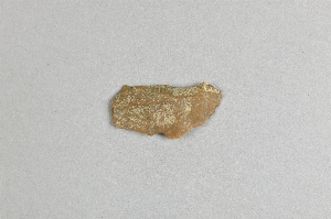
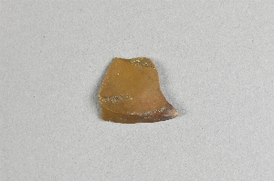
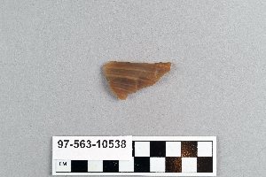
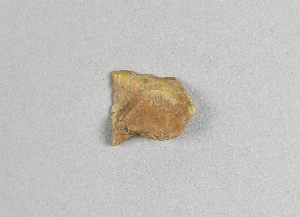
1 - 32 of 1,364 Records


